Day 11 — Waterfall #152 (9 July)

Before describing the day (our last on the road and the longest — 8 AM to 10 PM), I need to tell you that the Icelandic quack is: brra, brra said in quick succession — the r is rolled like in Spanish. Herdis had to repeat this several times. You know my hearing is not the best. But I think that it was more that I could not believe what I was hearing. I have to admit that I had a very difficult time understanding our Aussie travelers on both of our tours. Tuna is pronounced “chuna,” as an example. I worked hard without subtitles. My apologies to the Aussies if I gave a blank look or responded with a non sequitor to their questions or comments. But brra, brra? Too bad, I didn’t hear any ducks quack to confirm whether Icelandic ducks go — brra, brra.

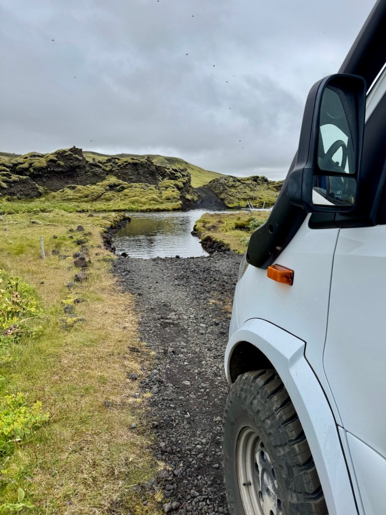
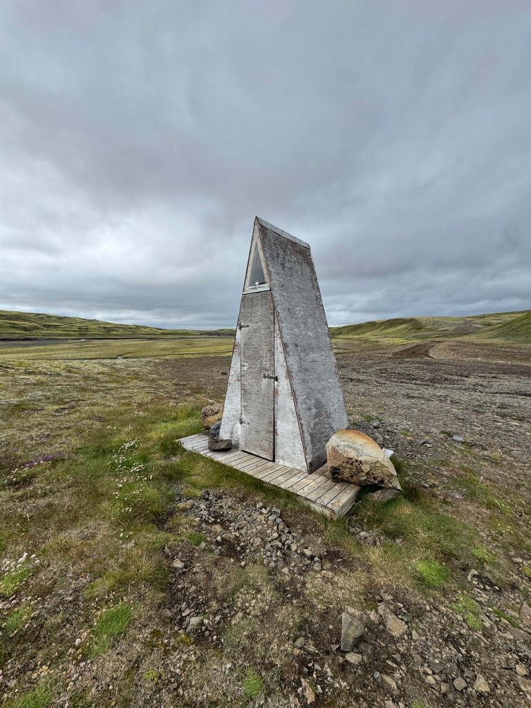
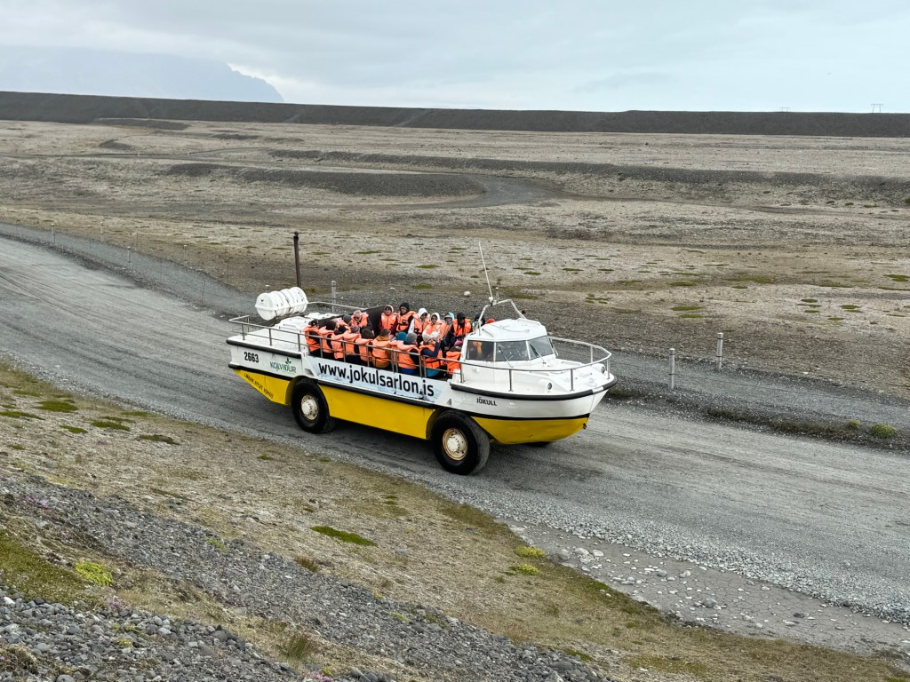
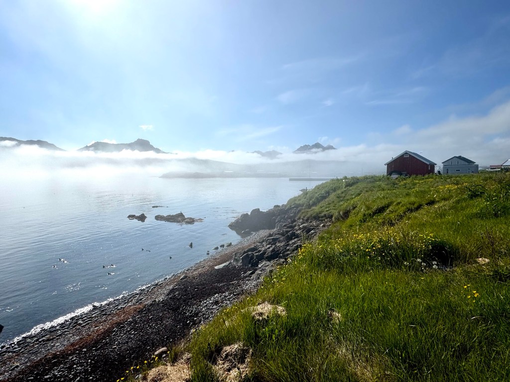
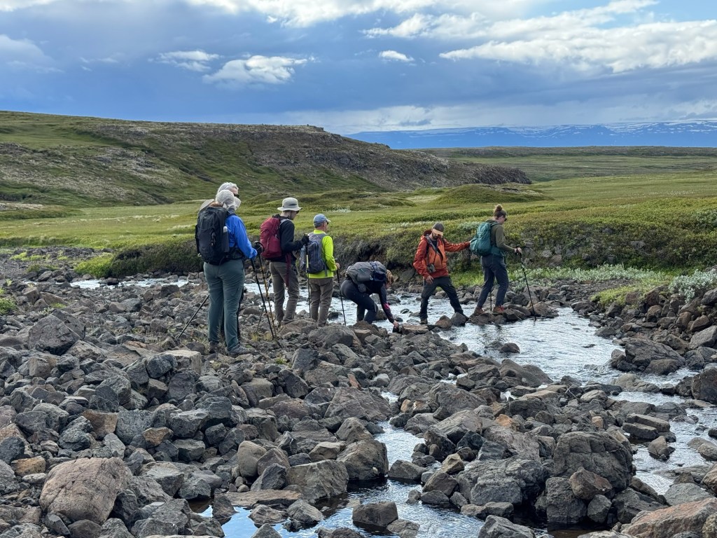
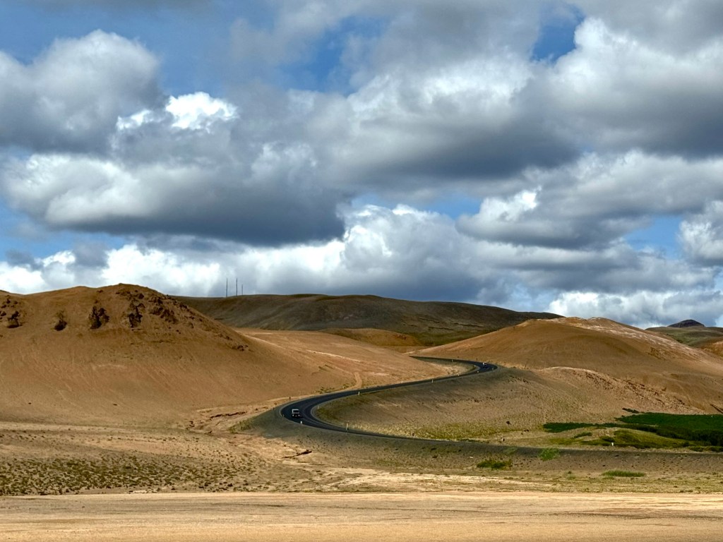
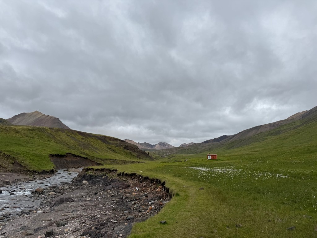
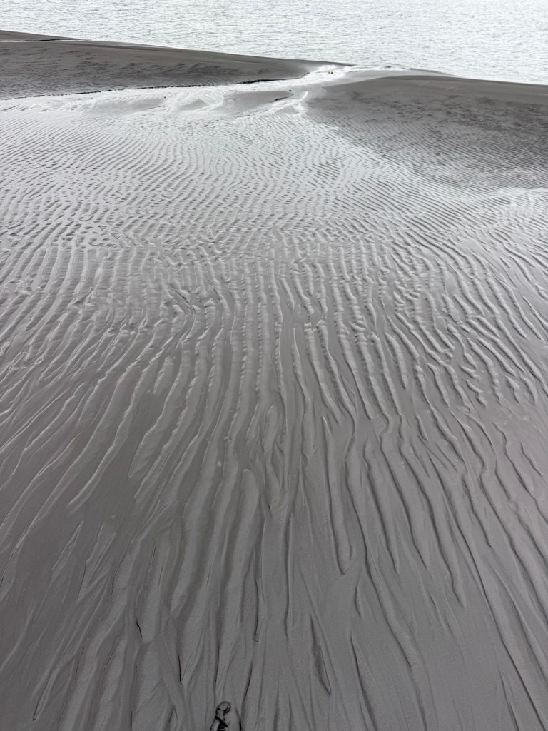
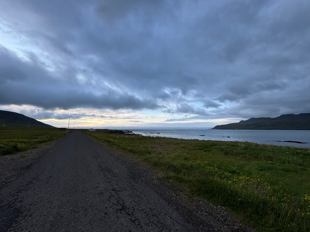
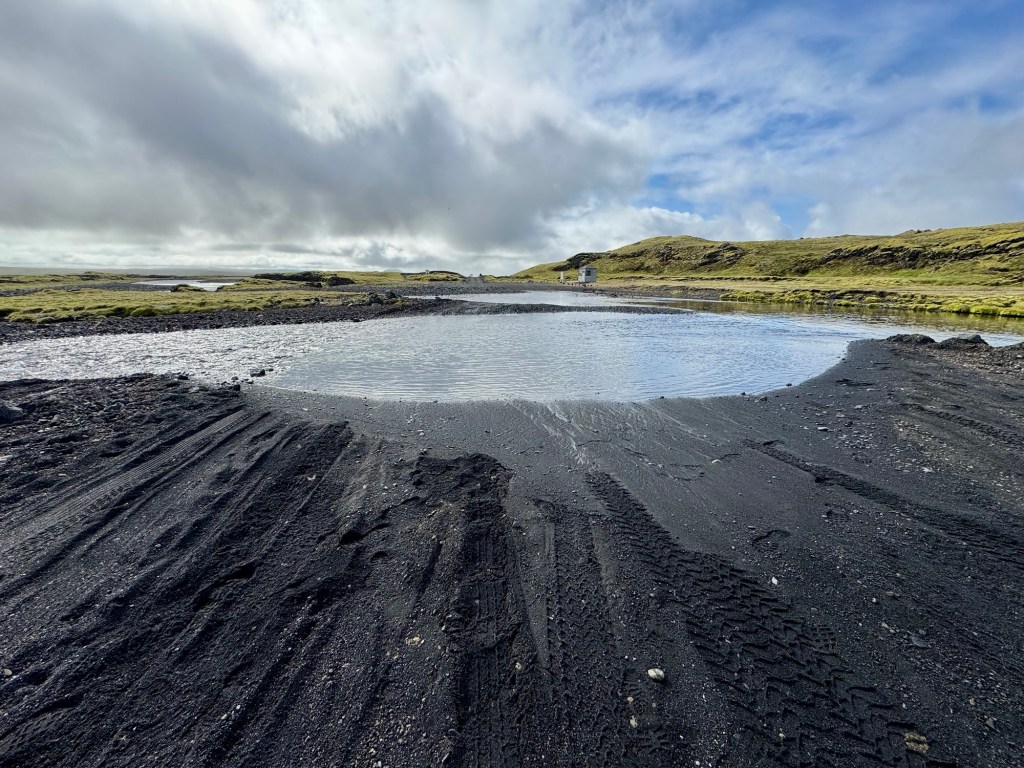
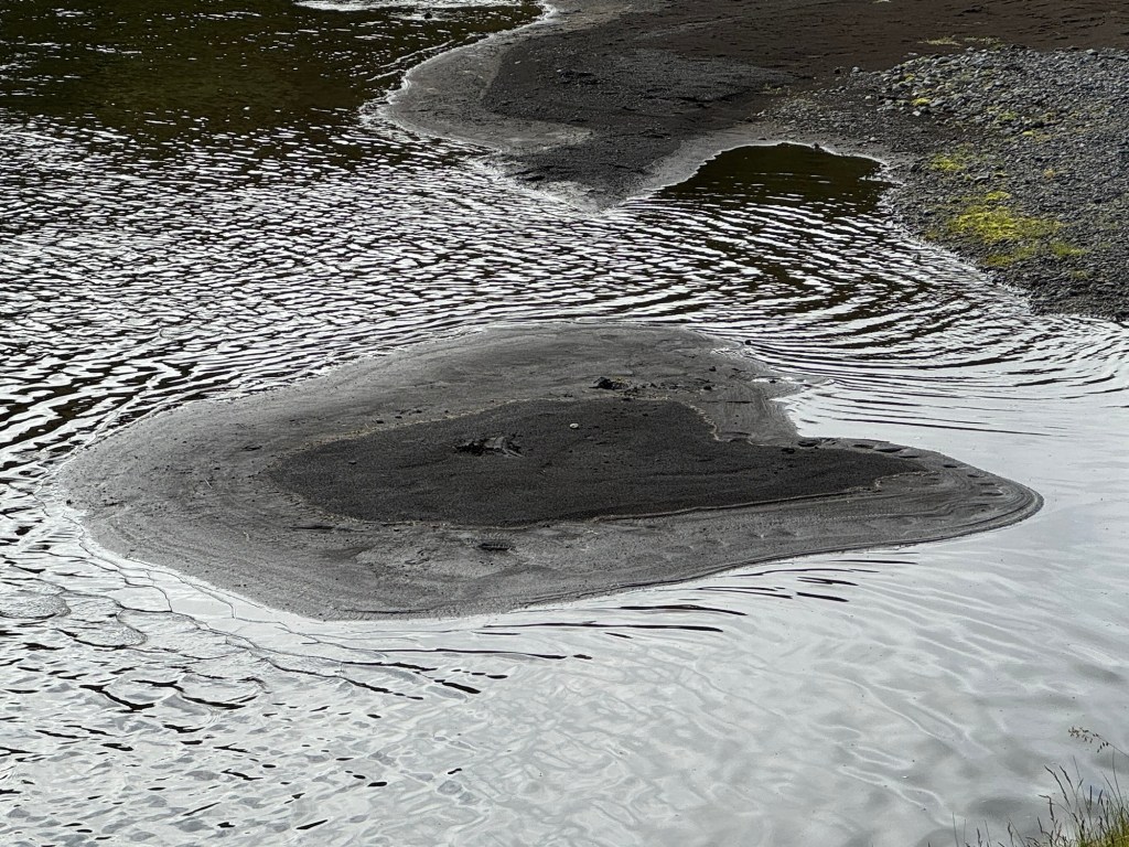
We were off to the highlands as Herdis called the interior of Southern Iceland. We turned right from Route #1 and were soon on a gravel road. In the US, we might use the term — washboard — to describe a rough road. I thought that wash cycle in a front loader would be a more appropriate phrase given the twists and turns that we experienced even at the slowest speed. Here is another image of our vehicle after we had crossed this stream. During the day, we would cross at least thirty more.

Crossing Another Stream

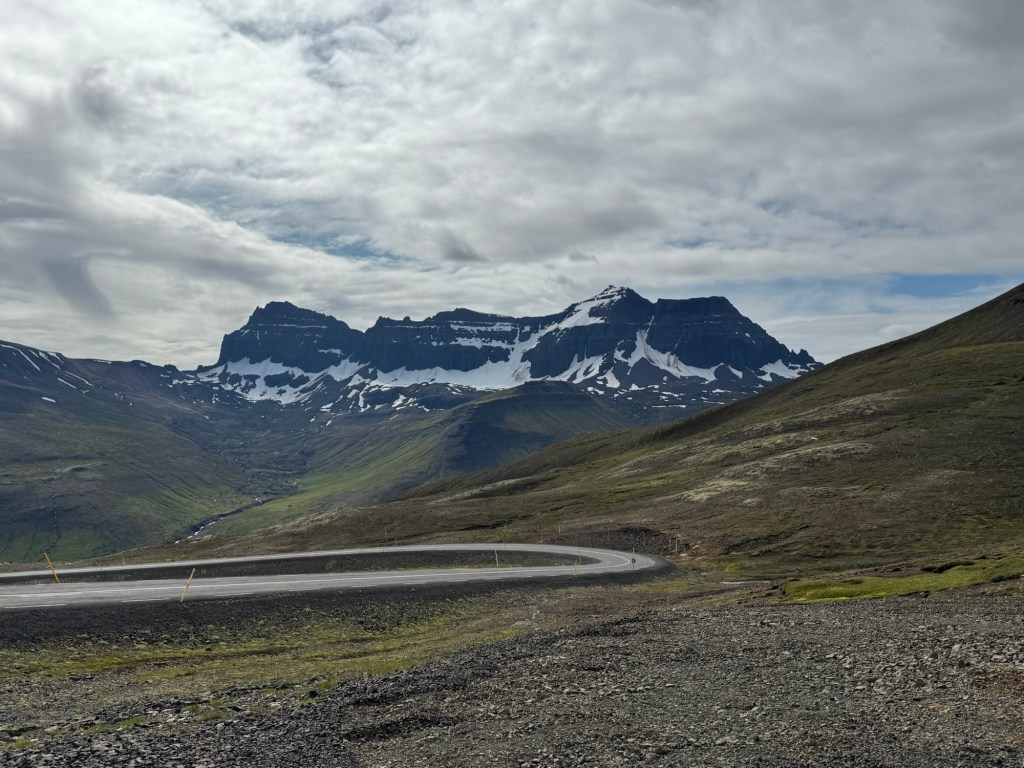
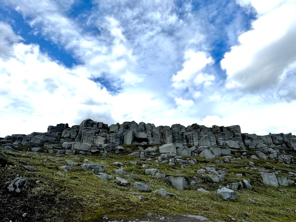
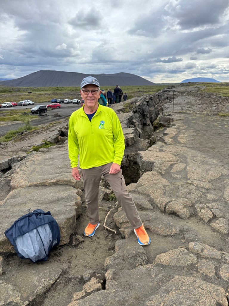
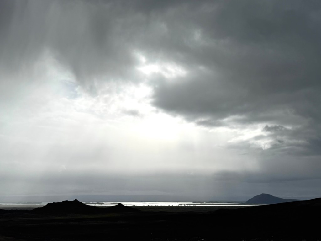
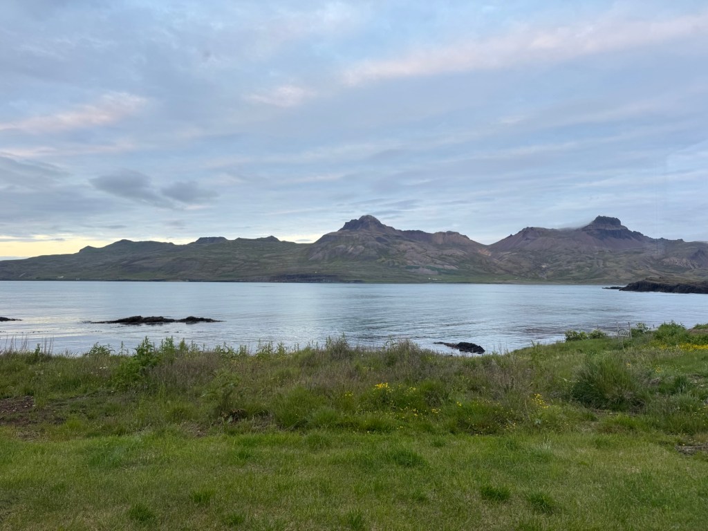
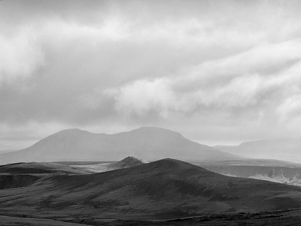
Soon after the turn, I spotted a mountain that stood out almost by itself — Mt Laki. Imagine that we walked in its cauldron the day before. Gives another perspective on the heights that we climbed.

Mt Laki

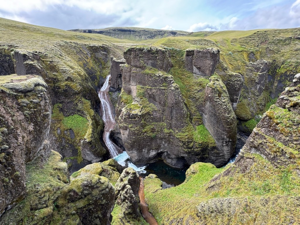
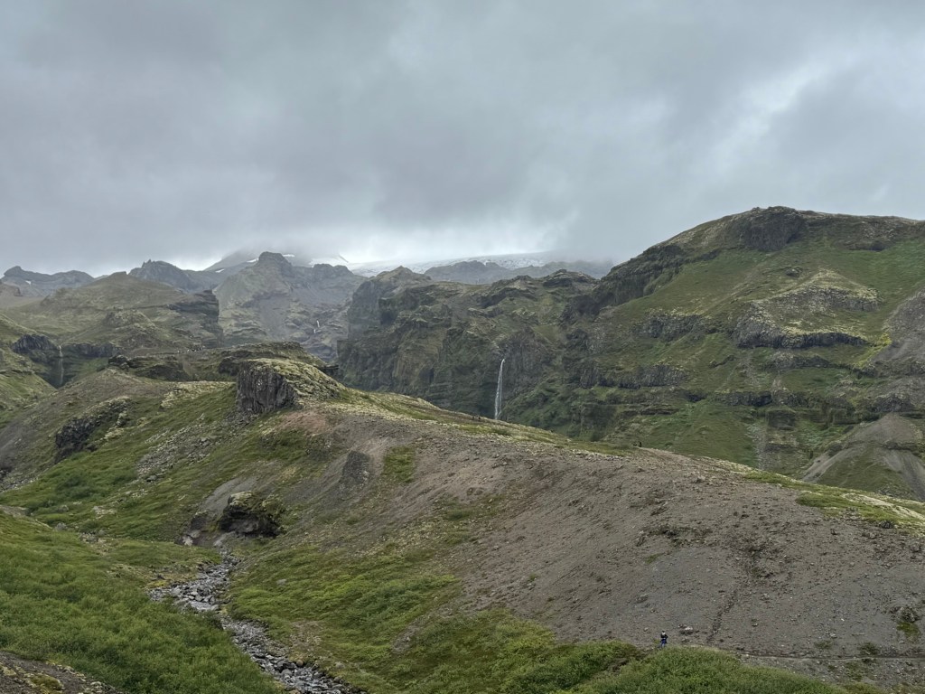
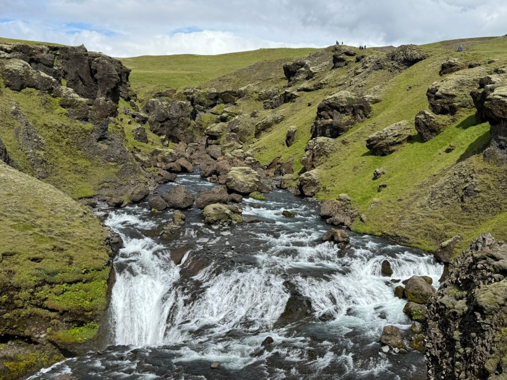
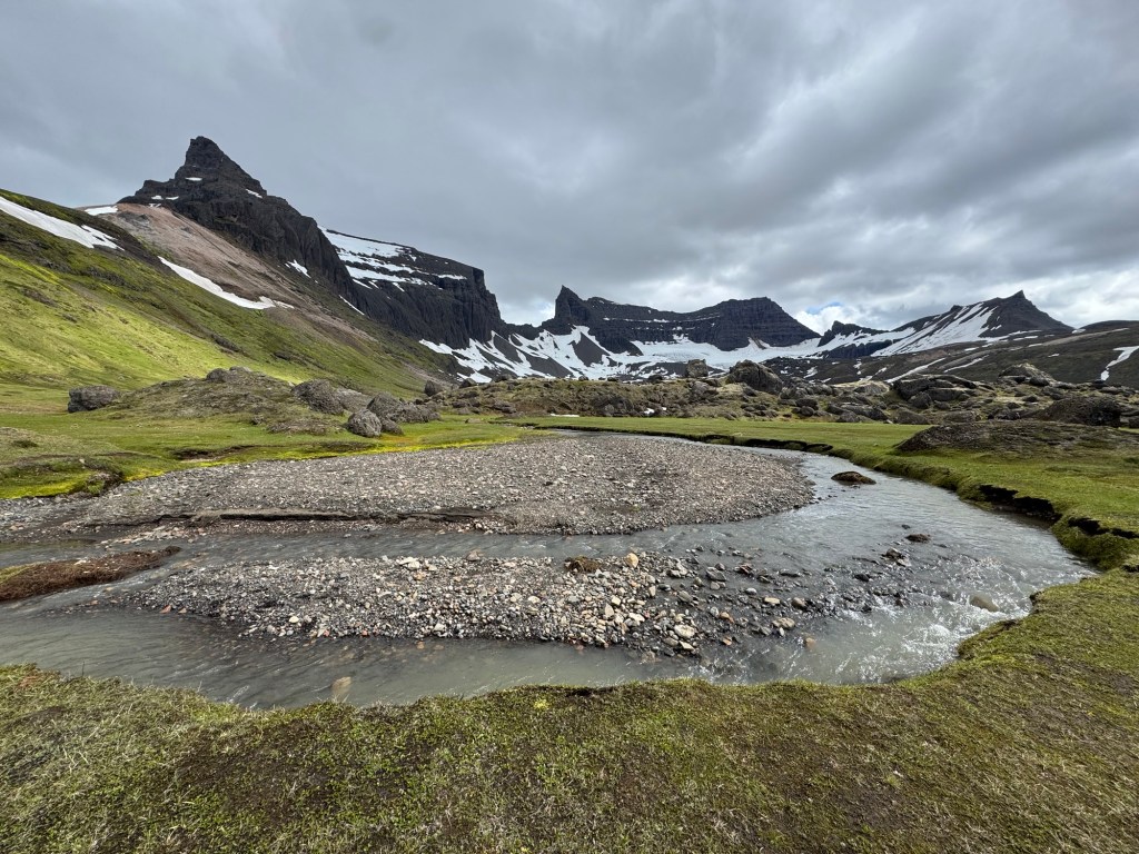
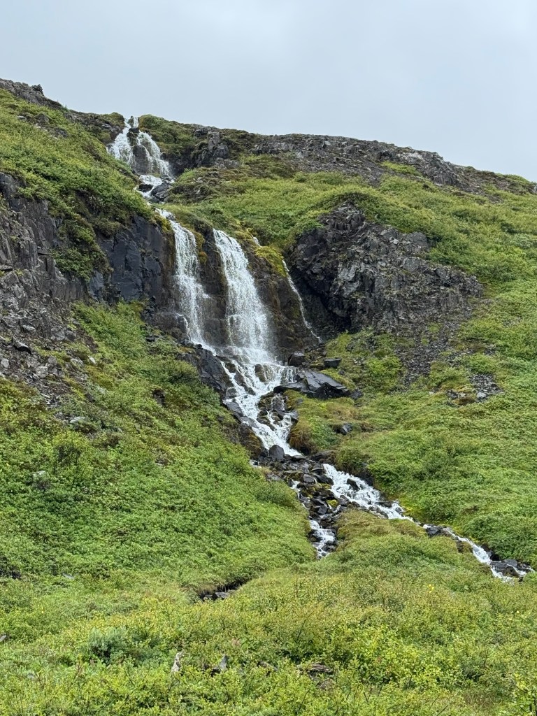
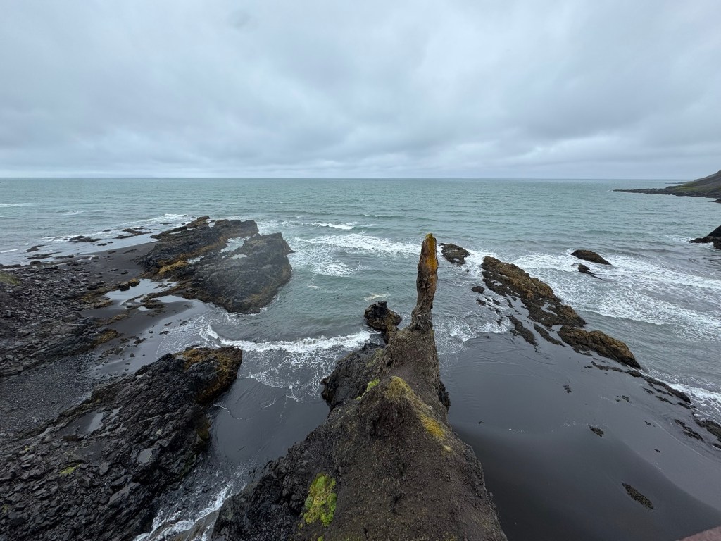
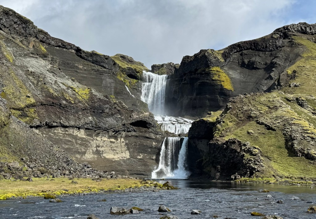
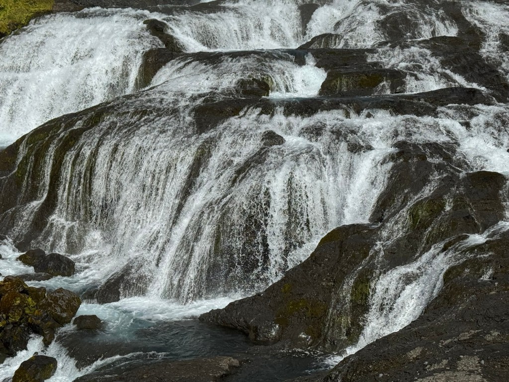
We arrived at Eldgja, a long valley within which was waterfall #152, Ofaurofuss, which once graced the cover of travel brochures for Iceland. This waterfall certainly is dramatic and stunning. Its distinctive natural arch that spanned the midline of the falls fell a decade or so before. Off the covers. I was saddened by this story because we all age and change. But alas, like Ofaeorfoss, people tend to dismiss the beauty that still remains. We climbed to the metal lookout platform where the natural arch once spanned the falls. Judge for yourselves.

Ofaerufoss
At The Falls
Flowing Water Over Stones

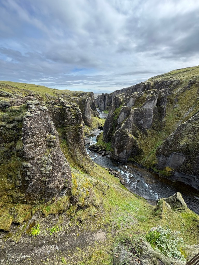
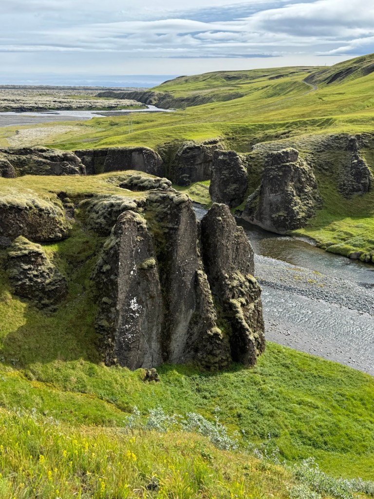
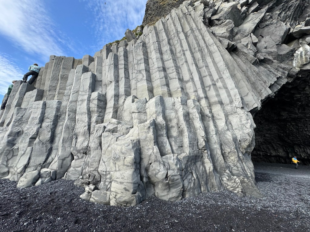
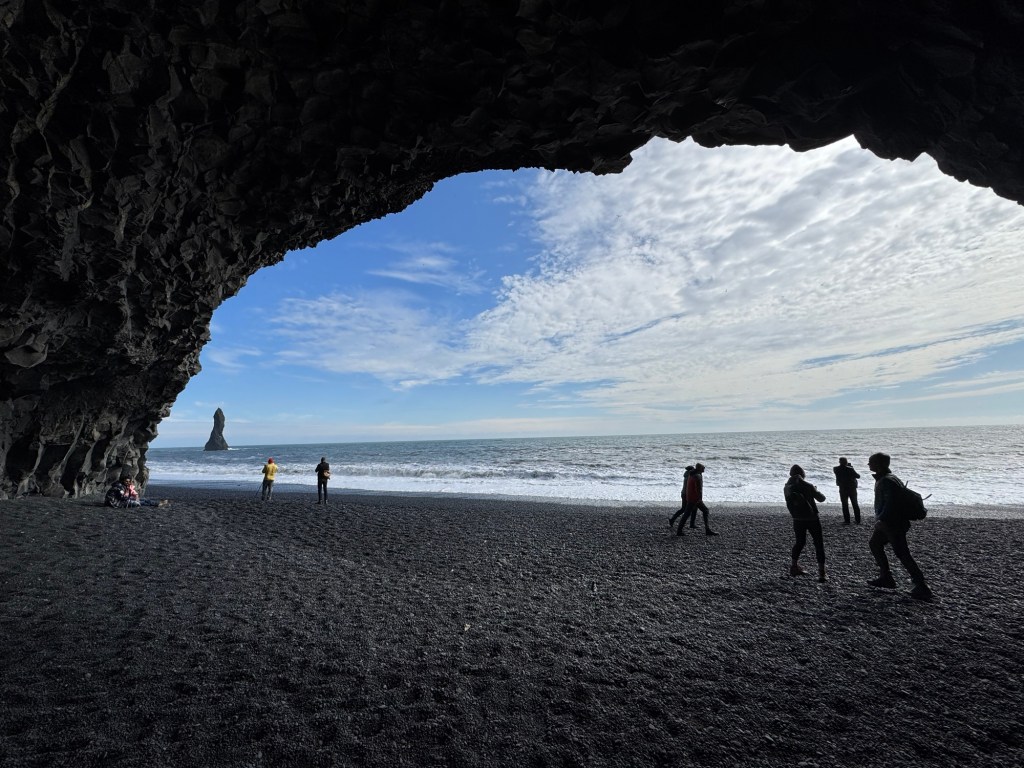
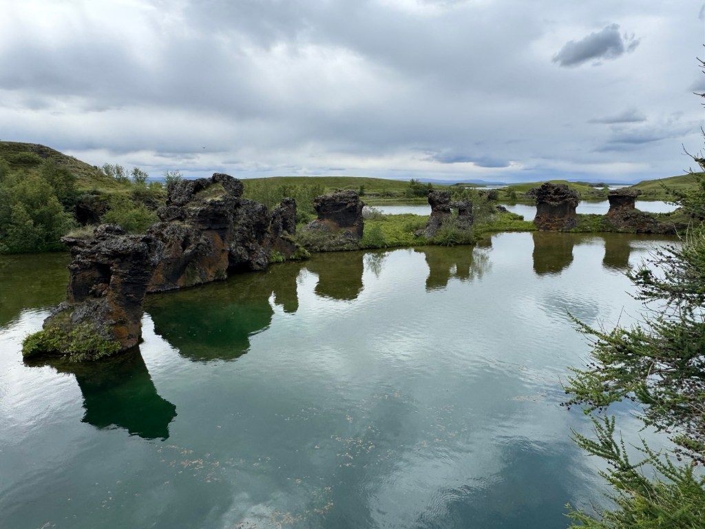
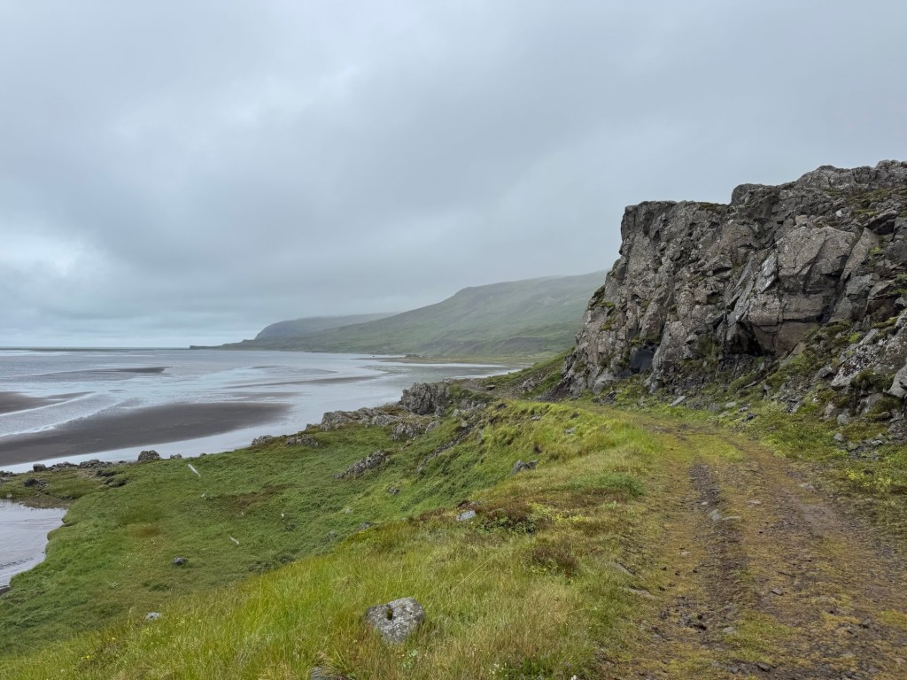
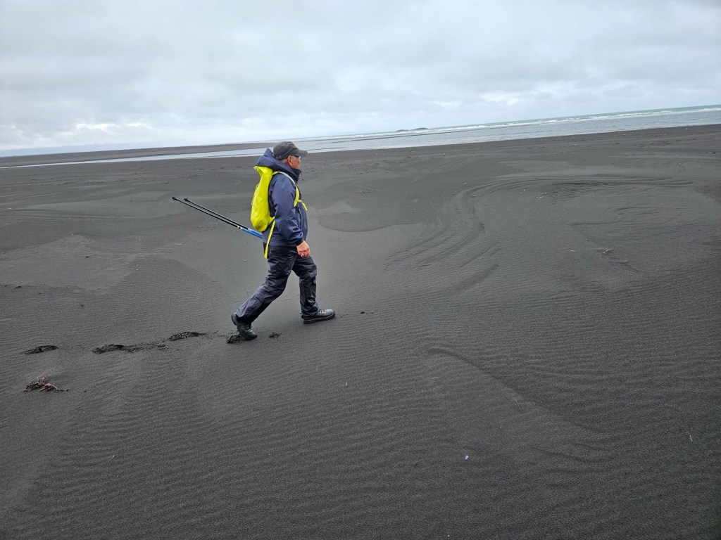
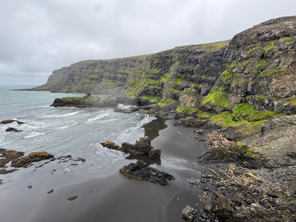
Here are some photos of the Eldgja valley at its entrance and our hike to the waterfall (about 4 km round trip). One could hike further to the end of the valley which ends abruptly like a crevice in a glacier. I would have liked to have walked the entire valley. So peaceful and the sky was bright with wonderful clouds. But….. this time, not a waterfall but a volcano was scheduled with the most extensive lava flow in the world.

Entrance To Eldgja Valley
Black Sand island
Along The River

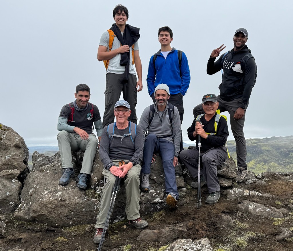
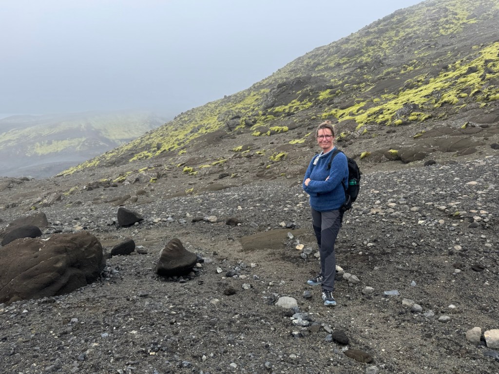
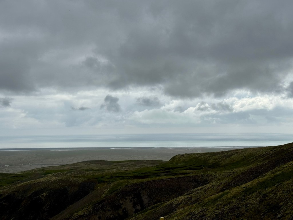
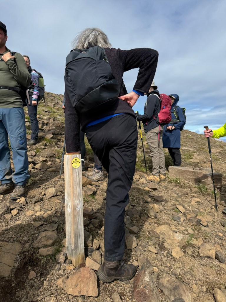
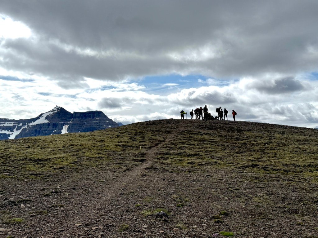
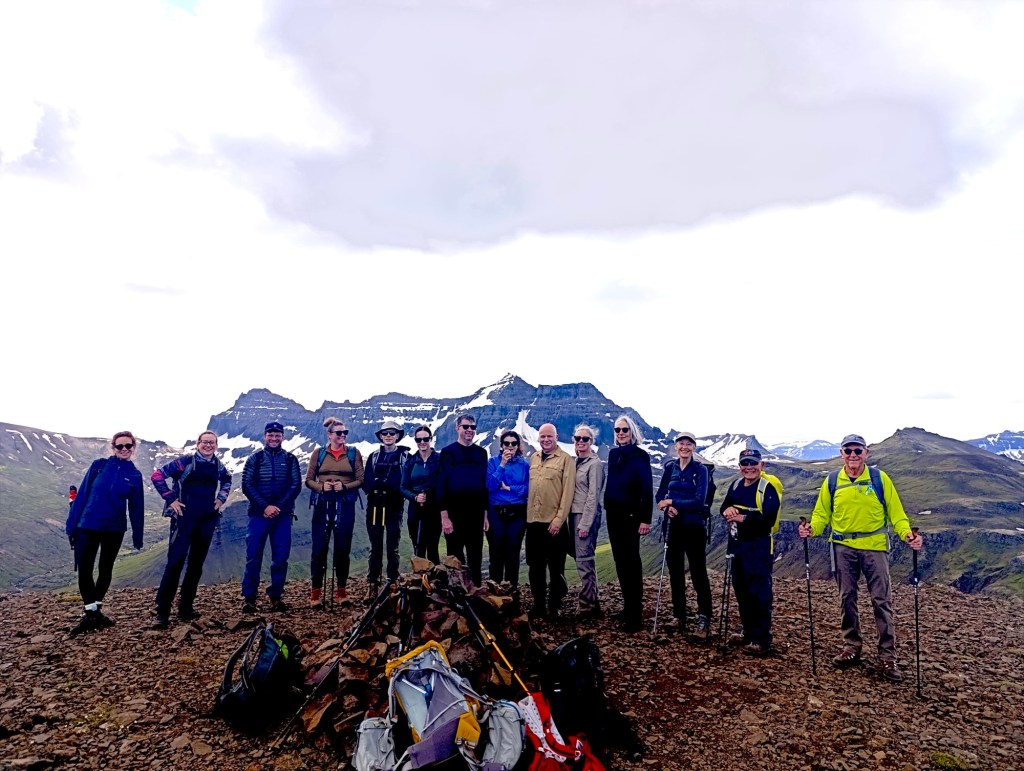
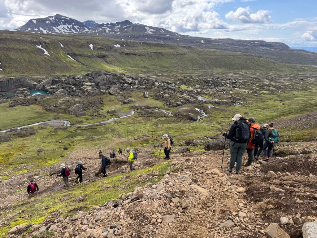
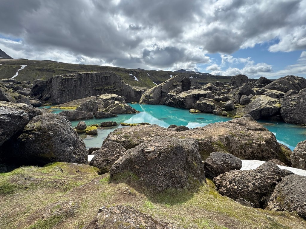
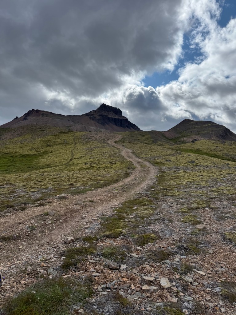
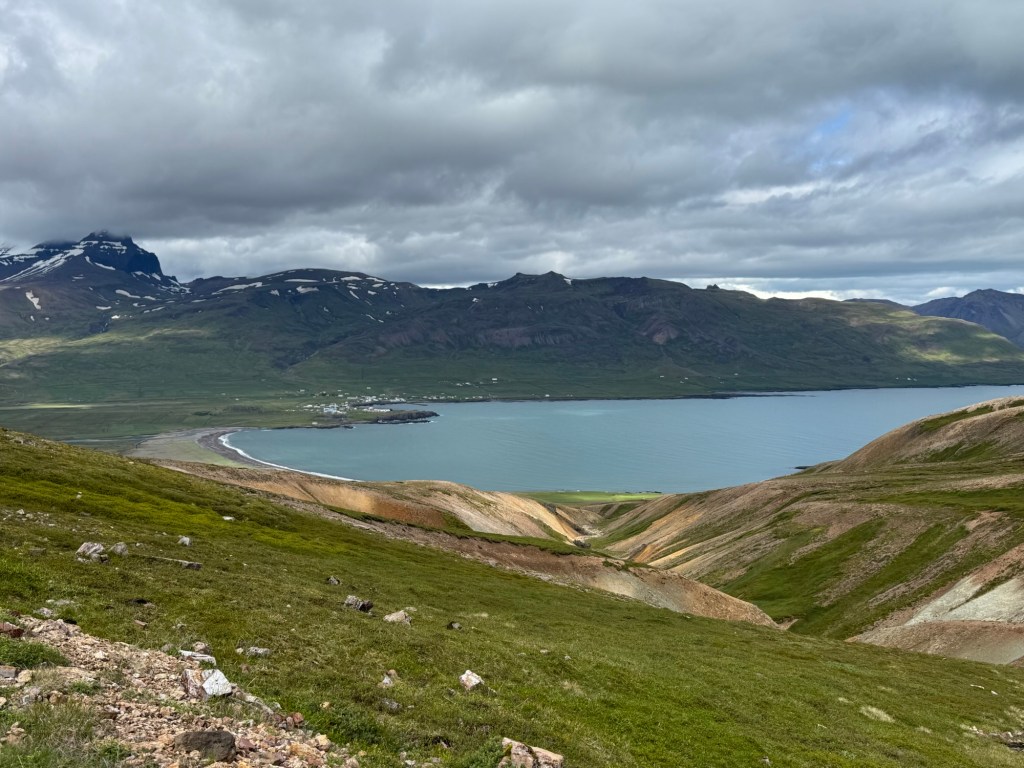
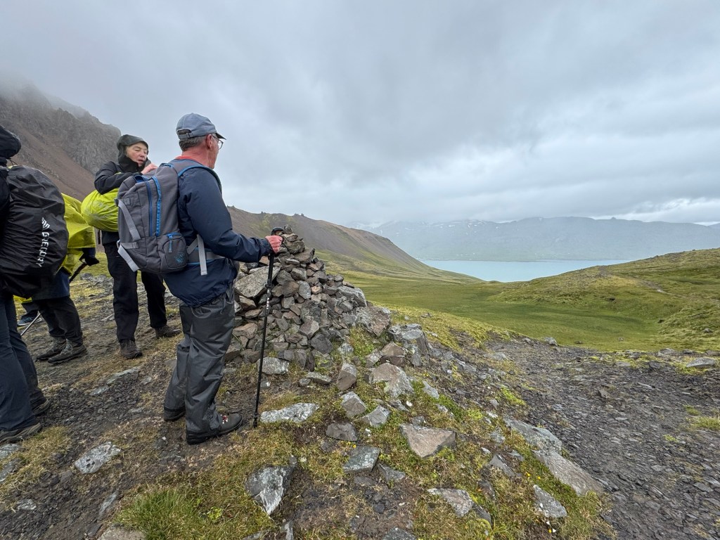
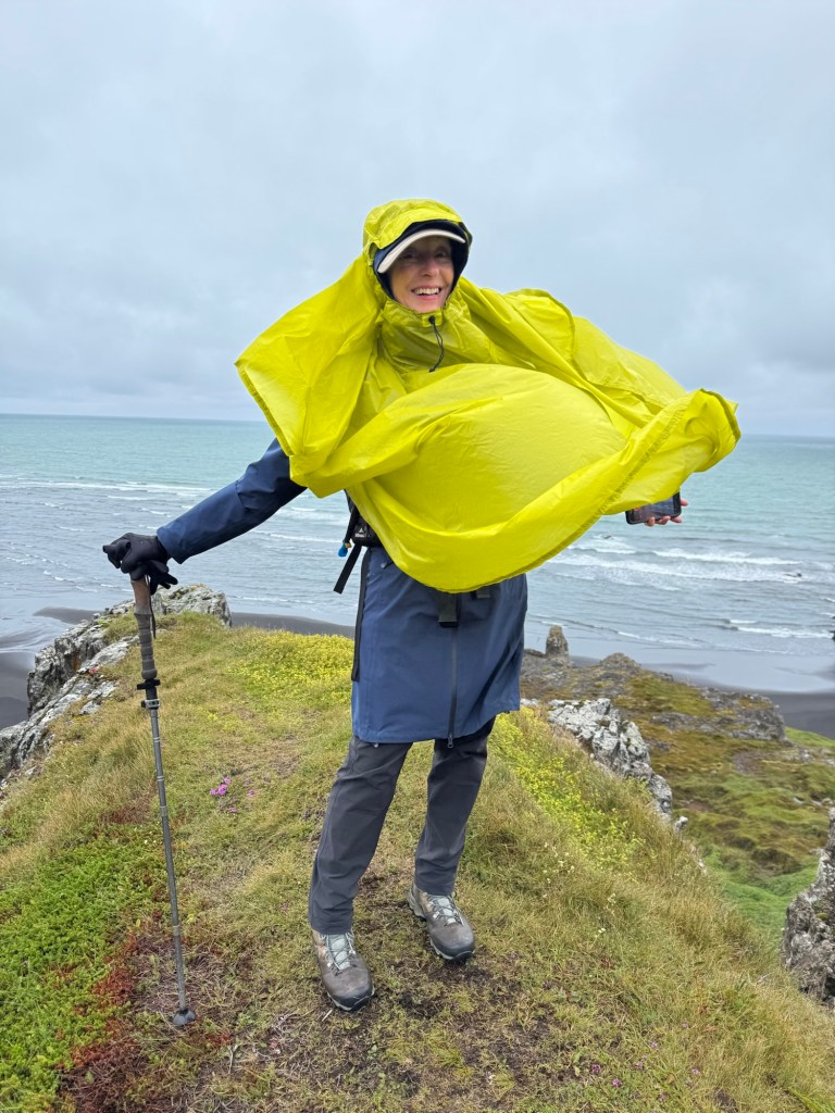
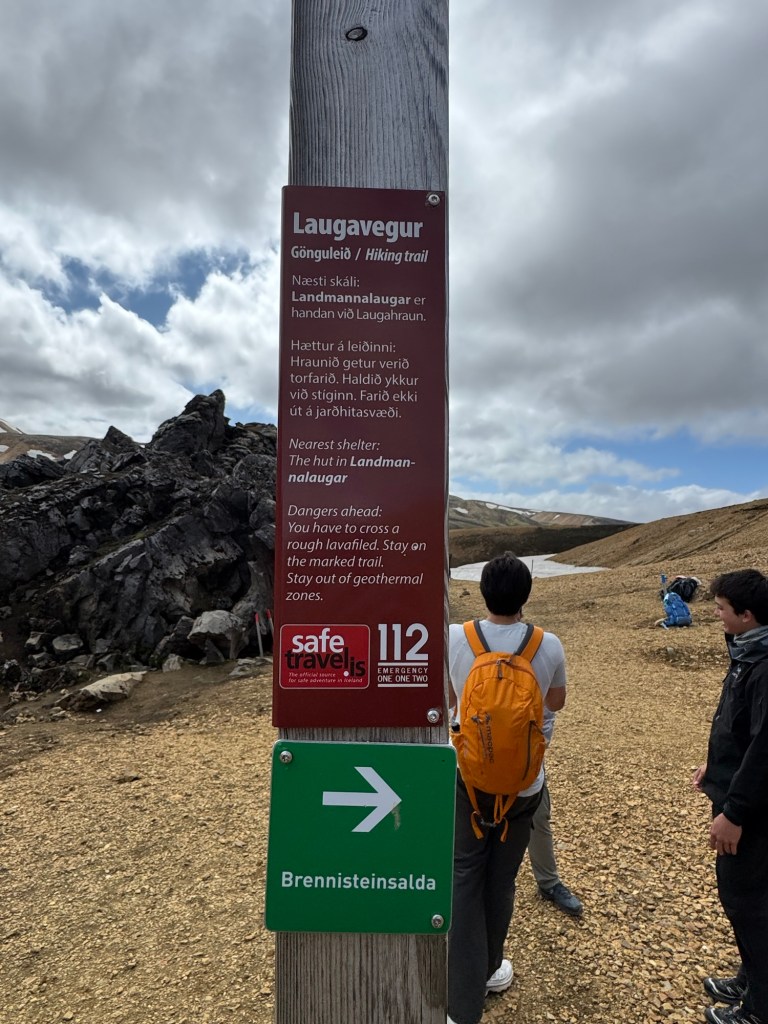
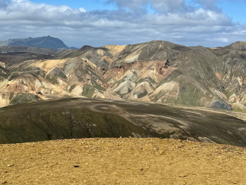
By noon, we arrived at Landmannslauger, a camping grounds and trailhead to climb the Blahnukur which overlooks the lava field, Laugahraun. We started off walking next to a river that is astride the lava field. We then climbed steeply until we reached the summit. The views were magnificent that were even more so because of the multicolored hues of the surrounding mountains.

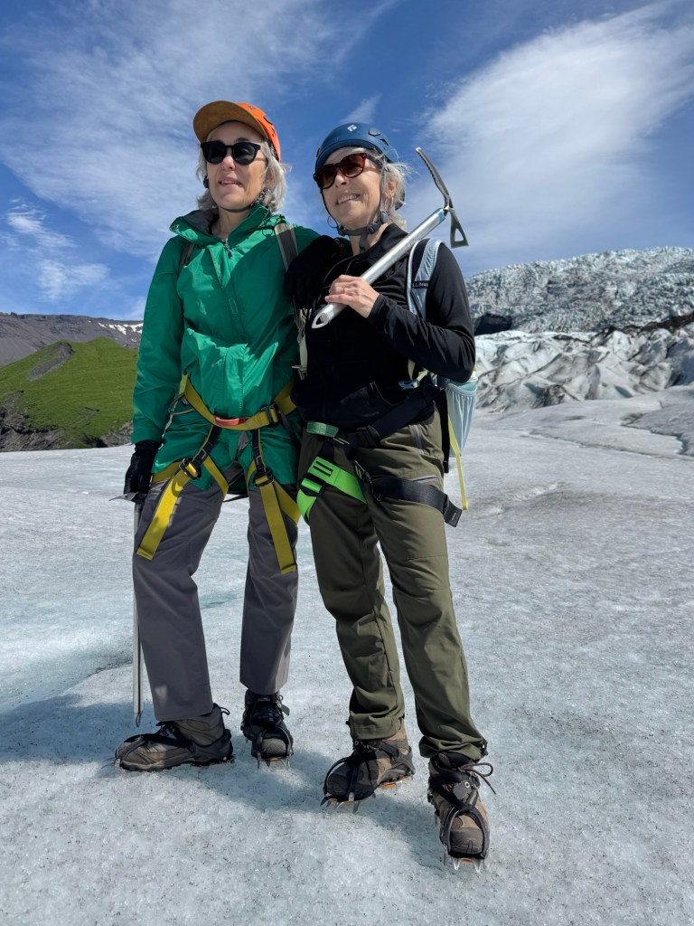
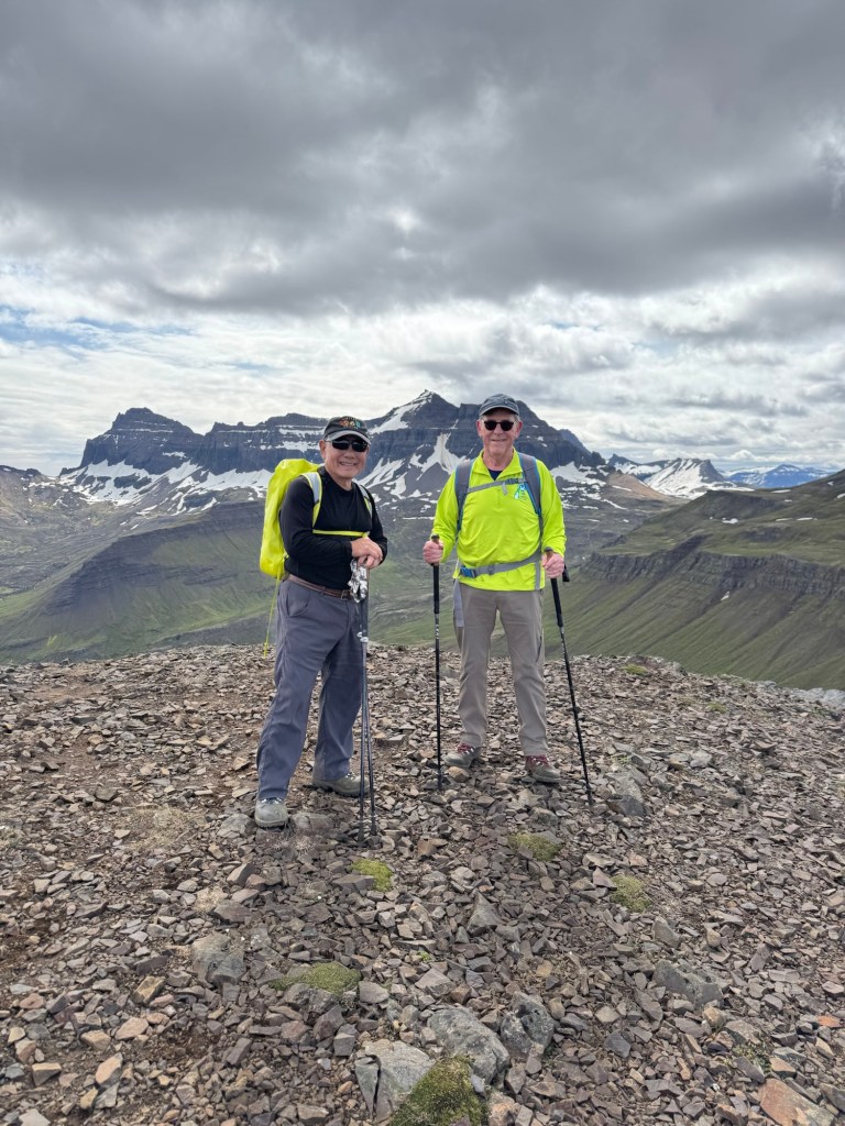
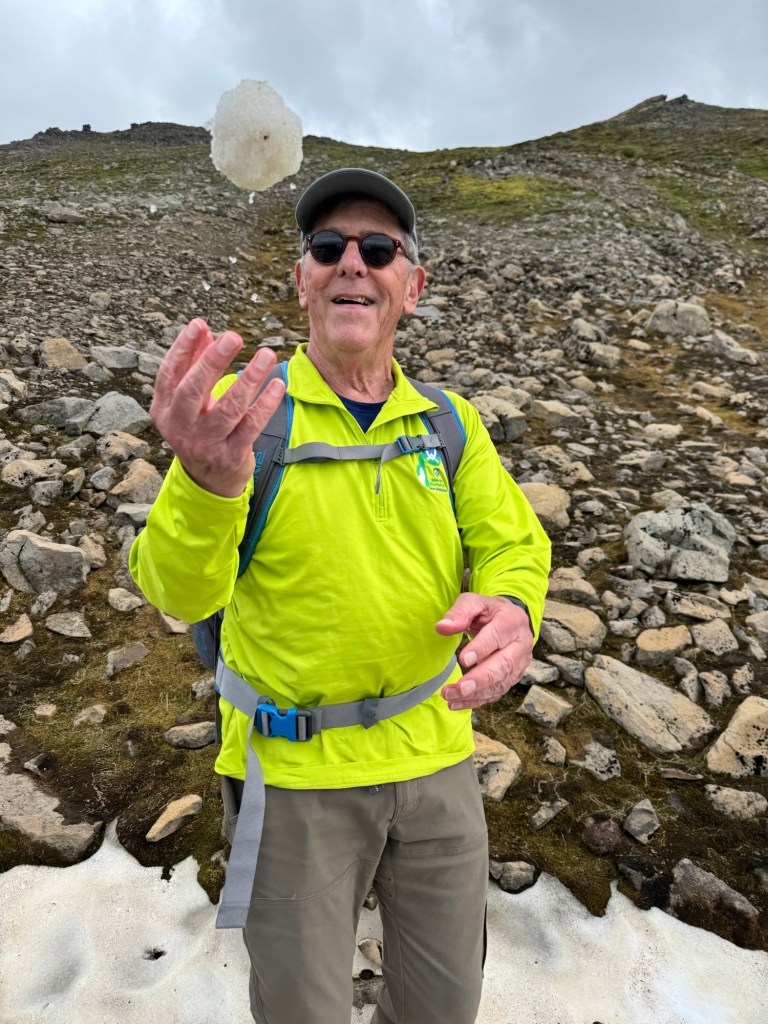
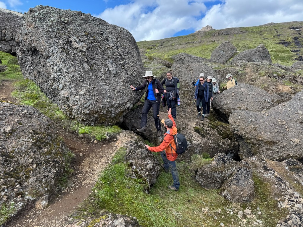
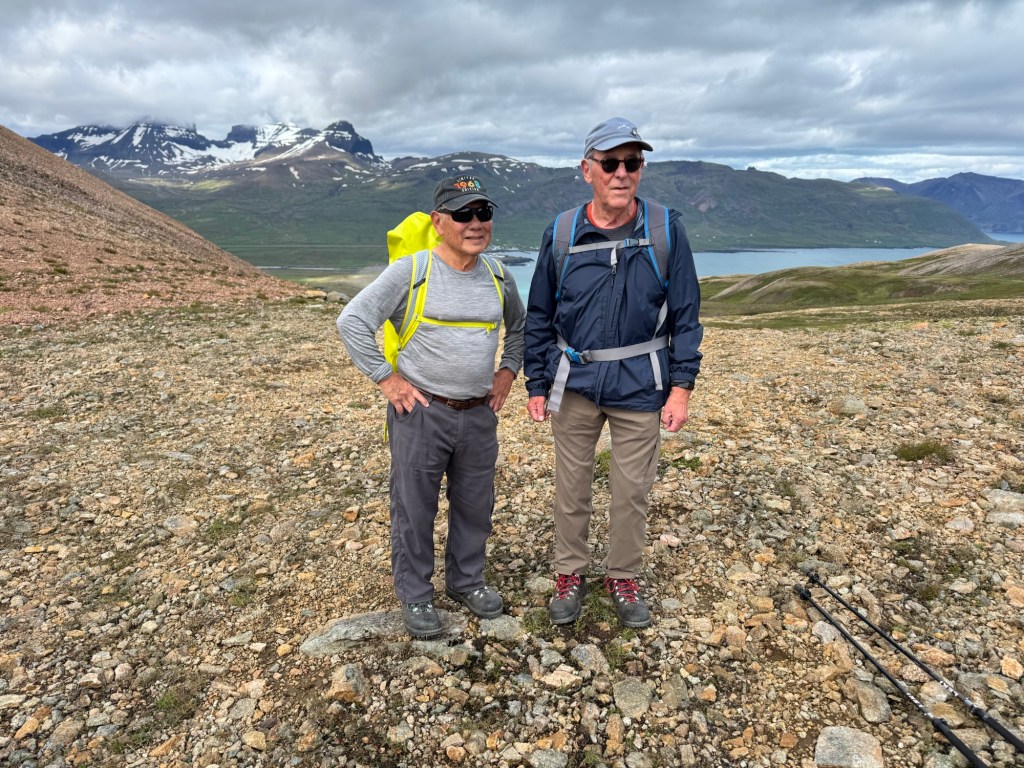
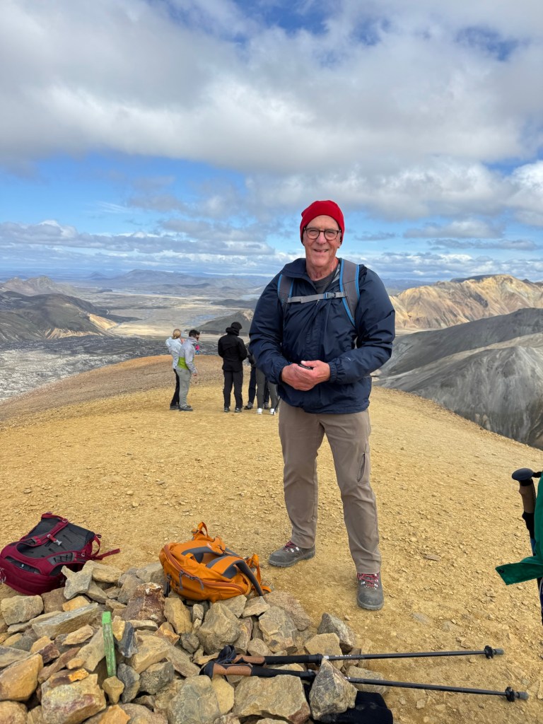
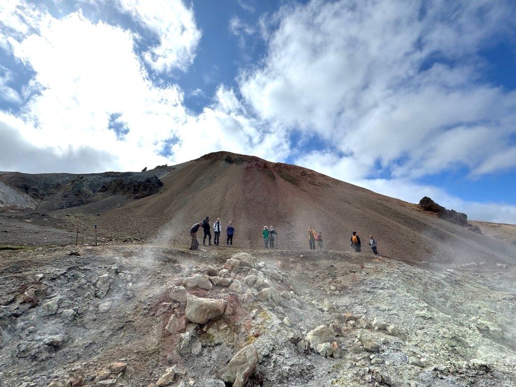
Unlike my trepidation on the canyon walk, I pushed to the summit. Physically not a problem, all mental about heights. The panorama at the top was something to behold. The lava field spread in front of us. The mountains had bold outlines in relief. The sequence of photos below starts with the trail sign at the beginning of the final ascent until the last picture showing the mountain from below taken next to the “mother of all gas vents.” Yes, it smelled.

Warning Post
Laird At The Summit
Mountains to the Left
Mountains To The Right
Descent Into The Lava Fields
Looking Back
Mother Of All Gas Vents

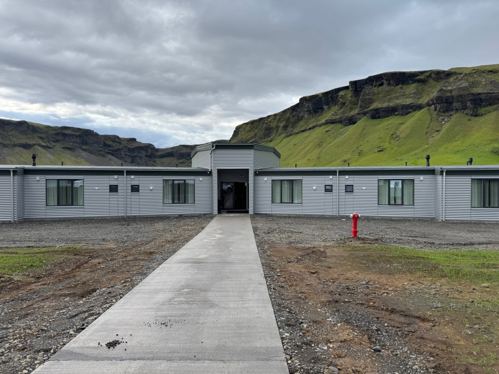
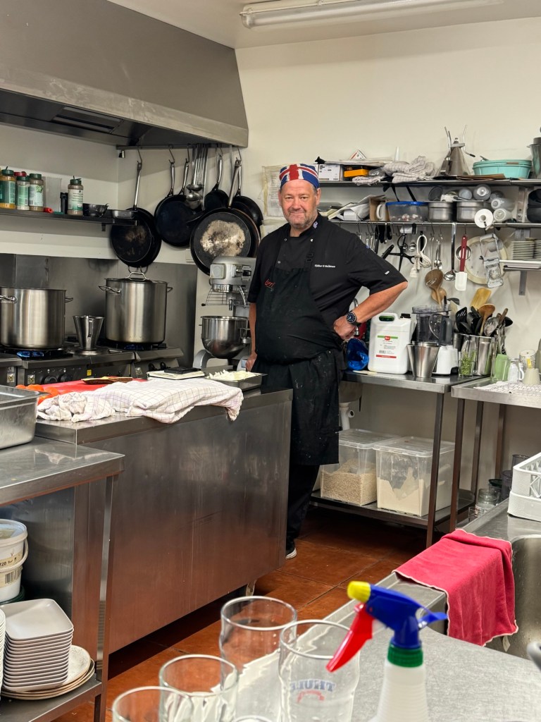
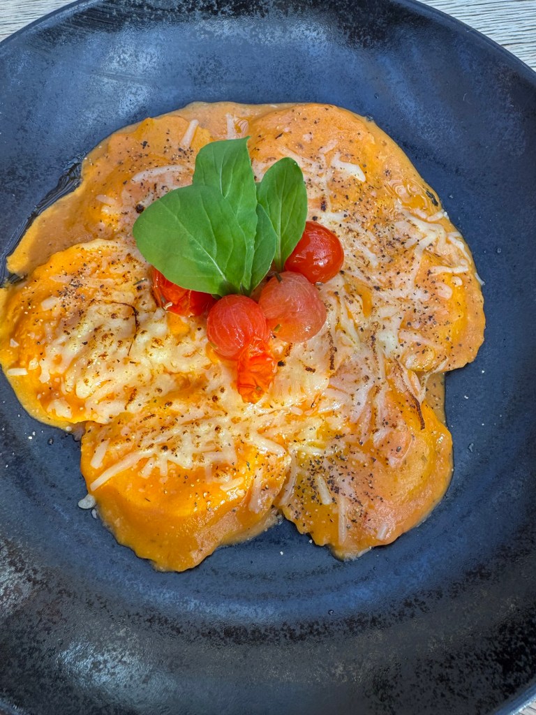
It was almost 5 PM when we made a dash out of the national park in order to make our dinner at the famous tomato restaurant, Frioheimer. On our Golden Circle driving tour, we had tried to find it. We failed. But on this last night, we were there as the last event of our Southern Iceland tour.

What a lovely setting. The dining area is airy and spacious. Next to our table was an enclosed section where lettuce and herbs were growing.

The Bar
Dining Area
Lettuce Hot House
Bloody Mary

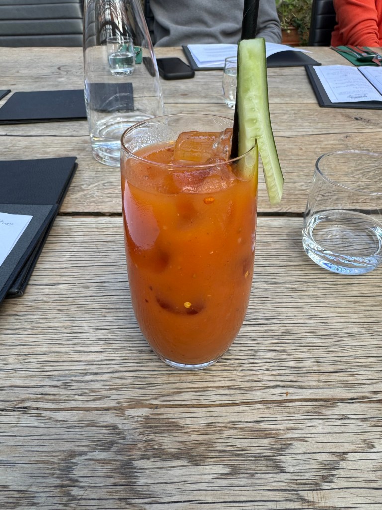
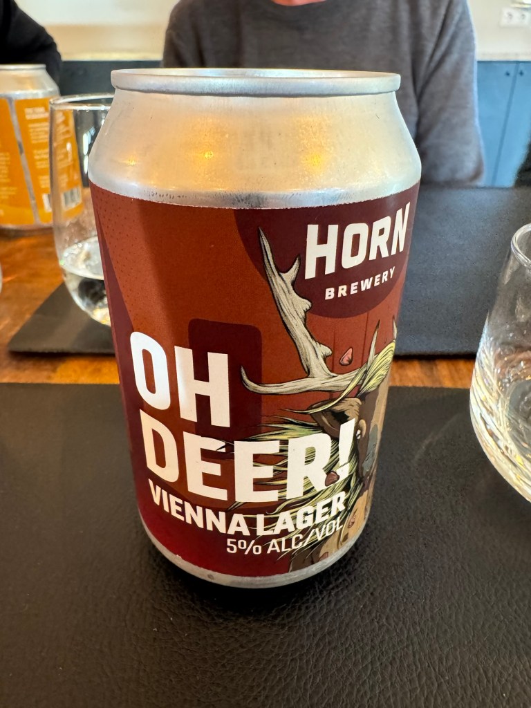
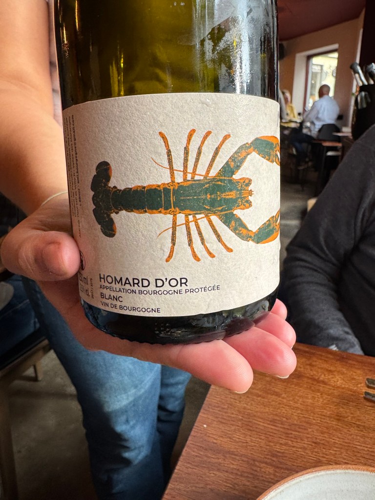
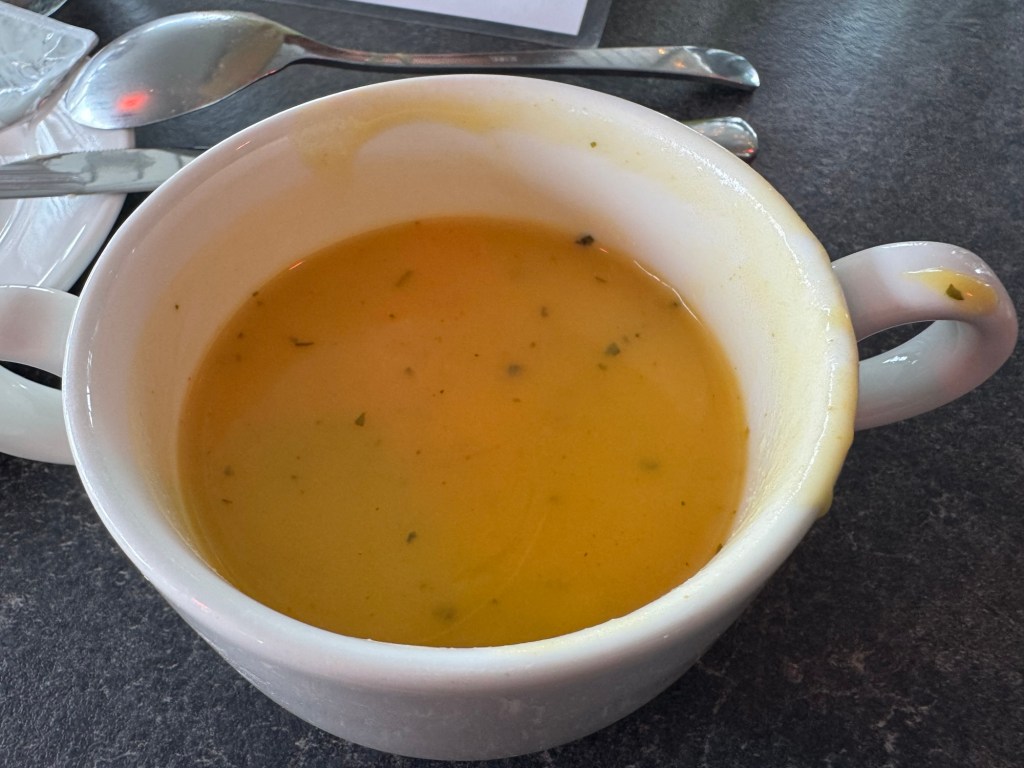
The food and drink? We sampled the tomato beer; we passed on the beer and had spicy Bloody Marys instead made with fresh tomato juice with seeds floating in the liquid. The 500 ml portion of beer came in an impressive glass.

500 ml Tuborg Beer

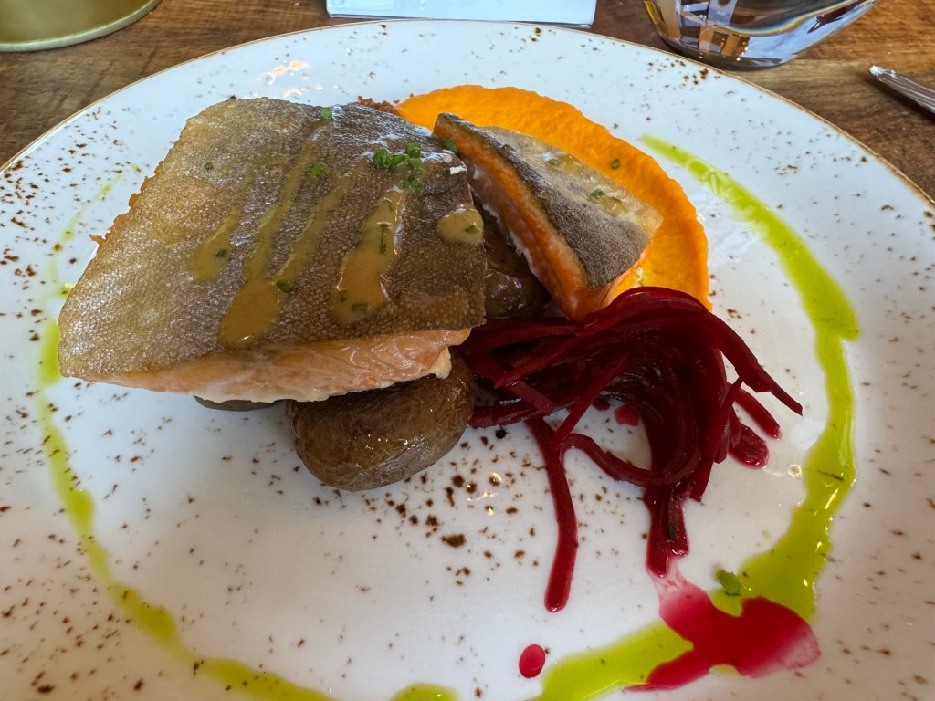
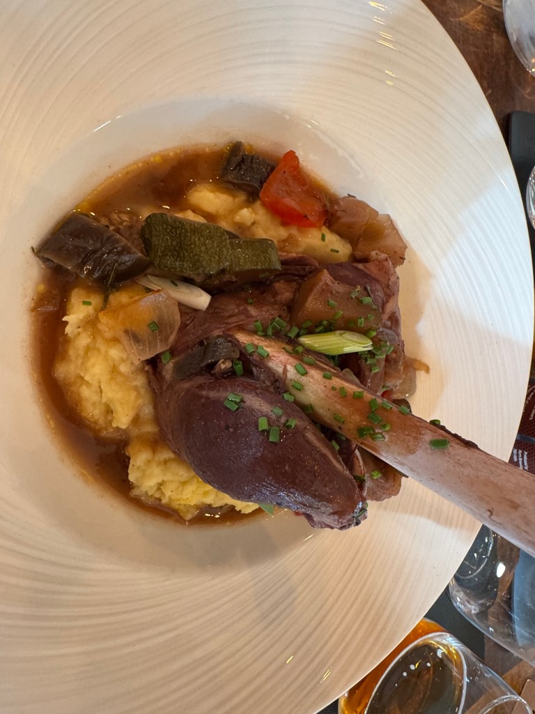
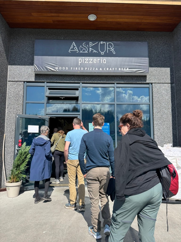
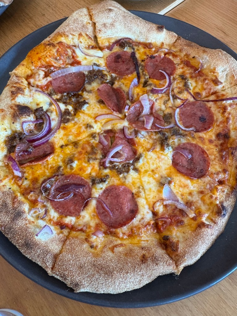
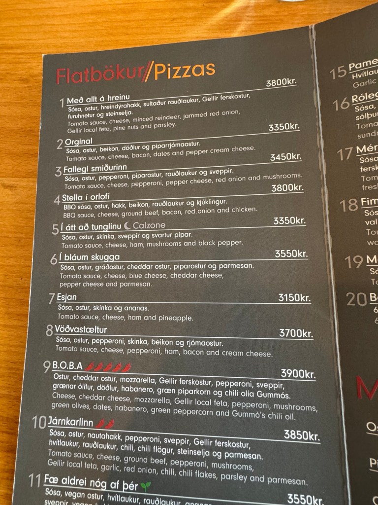
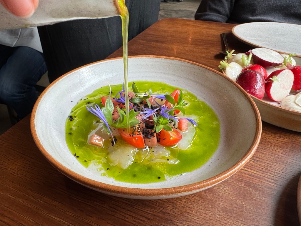
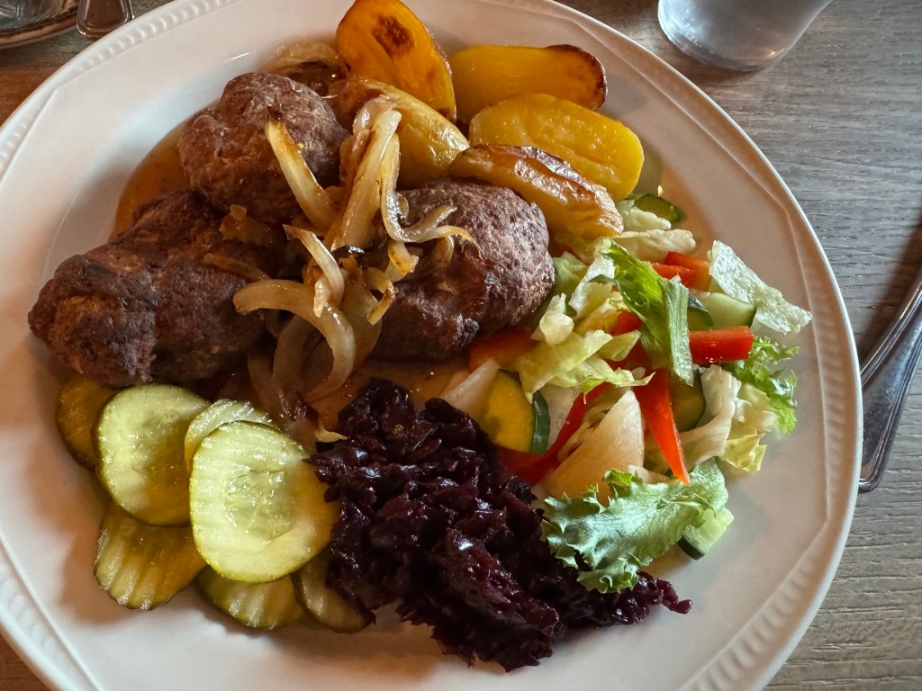
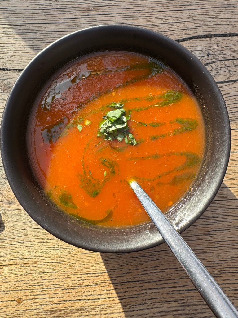
Every dish incorporated tomatoes. Here is a complete set of the dishes that the group ordered. Laird and I agreed that dinner here was the best we had in Iceland. However, I have to include the pizza at Askur’s in Egilsstaoir.

Tomato Soup
Bread With Olive and Tomato Topping
Tomato and Burrata Cheese Ravioli
Seafood in Black Ink Pasta
Salad With Lamb
Salad With Hot Smoked Salmon

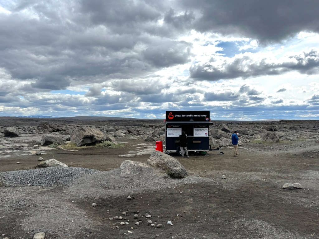
The tomatoes are farmed in mammoth greenhouses. We missed the last tour at 4 PM; we had just finished our descent in Landmannalauger, miles and a gravel road away. But we made dinner.

Hot House Tomatoes
A Hot House

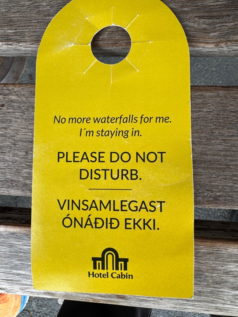
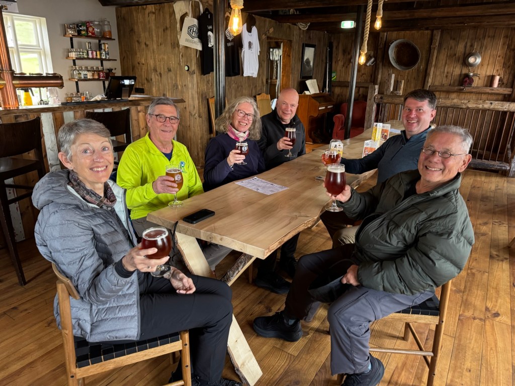
The final leg of our tour was completed when Herdis dropped us off at the Hotel Cabin in Rekyjavik. Time to say goodbye to Herdis and our fellow travelers. We had met wonderful and curious people on both tours — all strong hikers. We shared experiences that reinforced and heightened our sense of our world’s beauty.

Good night and good luck. (Thank you Edward R Murrow)

Day 10 — Mount Laki (8 July)

Mt. Laki, never heard of it until today. For almost a year starting in 1783, the mountain created a 15 mile fissure in the earth that produce a massive eruption that created 135 craters. The gases released into the air are said to have caused famine in Europe in 1784 and lost crops throughout that decade. Some historians claim that this prolonged period of famine may have been the catalyst for the French Revolution. The rim of the now dormant volcano was our main goal for this morning.

We turned off Route #1 onto a gravel road and drove for over 40 km. We went up and down, sideways as we drove over humps, holes, and streams. No ordinary car could survive this road. I almost didn’t.

The parking lot had about ten vehicles like ours when we arrived. You have to really want to come here. Glad we did.

Soon, we were climbing up on a rocky path that some German volunteers constructed a few years ago. When we reached the halfway point, the women in our group decided to pose for a women’s only photo. They must have been inspired by Iceland’s woman president, woman prime minister, women heading every political party, and the woman mayor of Rekyjavik. Not be outdone, the men took our photo but as you noted, dear reader, after the women.

About Halfway
Women On The Mountain
Men — Second On The Mountain

We had more climbing to do. We were in the clouds with the rim of the volcano still above us.

In The Clouds

Eventually, we reach the rim and began to walk into the volcano. One had to be particularly alert — the path could be tricky. We took our time when we confronted rough, rocky, and slick areas. We were rewarded with a moonscape. Did you know that Armstrong, Aldrin, and Collins trained for their Apollo mission in Iceland? We all came together — women and men — for a group photo. I also asked Herdis, our guide, to pose for a photo. I decided to put in a second — the Icelandic Viking pose. I heard music from the Ring at that moment. Valkyries arise.

Caution
Moonscape
At The Top
Herdis, Our Guide
Valkyries — Forward!

Time to descend as the sun began to peer through the sky. The Mt Laki eruption created 135 craters of various sizes. You can see one of the larger ones in the middle of photo below. The green color is moss that takes 100 years to grow. The black areas are fields of black lava. Our group in the lower left is only at beginning of our descent. Yellow stakes mark the trail which was ready to twist an ankle, pop a knee, and freeze a hip. The trail smooths out towards the end.

Lava Land Below
Closer View Of Crater
The Risky Road
Near The End

We continued to our next destination, a large crater called Tjarnargigur where we stopped for a lunch break. Most of our group was hungry, not surprising after a jaunt up a volcano, no? Surrounding the crater was a black lava field upon which nothing but patches of sea campion grow. I once saw a similar landscape colored in brown at Crater Lake, Oregon known as the pumice desert. The minerals that are expelled during an eruption are so devoid of nutrients that only a few plants can grow in them. It was eerie to see such a large black (perhaps blank) canvas cover the ground.

Pumice Desert Iceland Style
Sea Campion

We walked around the crater on a smooth path that included a boardwalk so that we didn’t walk on the 100 year old moss. Another crater, yawn, after hiking Mt Laki. When we rounded the crater, we were rewarded with a beautiful lake set amongst the rocks. What a surprise.

100 Year Old Moss
Lake Surprise
The Canyon’s Waterfall

The gravel road presented challenges throughout our day’s journey especially on our returning route. The first photo shows our vehicle approaching a stream to cross. In a more open area, the photo shows the van in the water. Herdis helped stage this photo by dropping off interested photographers on one side of the stream and then re-traced the bus’s path to pick us up. Thank you Herdis.

Stream Crossing
Mercedes (Ford) Every Stream — Oscar Hammerstein II

And then, another waterfall. I groaned but this one was one of the best. Herdis asked me how many Laird and I had seen on this trip. Perhaps 150 give or take a few. I know that a few more will be coming up tomorrow. I’ll keep the yawns to myself. But the stop did offer the opportunity to photograph the original style WC found in these parking lots. Newer ones having running water.

Waterfall #151
Original WC Standing Tall

Our final stop was Fjadrargjufur, a most impressive canyon that starts with, guess what, a waterfall and is bounded by massive blocks and columns of stone unlike other canyons we had seen or hiked. I wondered how it would feel if one could walked or waded down the canyon. Laird said that it would ruin photos with the masses of people in them. We also took the high road and speculated about the impact of people throwing rocks at the stone walls, climbing and scrawling graffiti on them. Not a pretty picture. Let’s keep its beauty as is.

Waterfall At The Top
View From Upstream
The Three Sisters (My Title For them)
Downstream View

Our touring for the day ended. Now, the mundane — dinner. Herdis booked us in at the, meaning in this case, only local restaurant where our hotel was located for the only time available, 6 PM. By 7, the place was jammed with people waiting in the reception area and out the door. Be sure to read the specials board carefully.

The food was excellent. Even locals dine here. As we left the restaurant, I ran into two couples who had shared the hot pool with us yesterday. I thanked them for having a wonderful country. One guy hugged me which made him suspect as to whether he was a real Icelander. One of the wives asked me whether the husbands looked better in the pool or in their street clothes. I passed on that question. I did find out Icelanders quack like ducks.

Local Restaurant
Specials Of The Day
Dianne’s Salad
My Fish and Chips
Herdis’s Pizza
Heather’s Risotto

Everyone was happy with dinner. Wasn’t the salad just stunning? A vegan’s delight. My fish was flavorful and firm. The fries were medium to crisp — not quite the crispness that I received on the second try last night. Herdis loved her pizza. I didn’t order a pizza because a 12 incher seemed to be lot. It was but that did not stop the others who ordered pizza. No take home boxes for this crowd. Heather said that the risotto was very good. Must have been because she is certainly a member of the clean plate club.

Thus, another fulfilling day ended even with more waterfalls.

Day 9 — Sky and Water (7 July)

Mulagljufur was our first trailhead this morning. The hiking path winds its way up the spine of one side of a canyon. Here are some images of from the climb.

Descending To Cross River To Meet The Spine
The Spine

About 1000 feet up, one faces the waterfall at eyesight level. This waterfall can be seen in distance in the above image. This falls reminds me of Yosemite Falls. A narrow band of water in a long free fall.

The Falls

This drop and those that I imagined looking up the path from this spot prevented me from continuing up the spine. Everyone else did and came back excited that they had made the complete climb. Laird told me later that there was one segment that was three feet wide with drop offs on both sides. I probably would not have made it across. I waited for an hour until the group returned at the spot where I took the image. While I sat in a rock formation that blocked the wind, I talked with passersby and meditated about my surroundings which were awesome.

Clouds Looking SE
Touching The Clouds
View From My Seat

After the descent, we drove further east to our farthest point from Reykjavik. We were almost in the Southeastern section of Iceland. We encountered Jokulsarlon — the Ice Lagoon, and the Diamond Beach. Do did hundreds of others.

Tourists At The Ice Lagoon

I have seen glaciers elsewhere but not with their calved icebergs so up close and personal. You can even get closer to them if you board the “duck” boat. Sharon and I boarded a “duck” boat in Pittsburgh and Philadelphia several summers ago. The operators in those cities asked you to quack at bystanders when we were on city streets. Good fun. We didn’t hear any quacks here. What sound do Icelanders make for a duck? This vehicle can go on land and in the water.

Icebergs On The Loose
The Duck Boat

The Ice Lagoon’s waters spill into the sea. As the icebergs split into smaller pieces, many of them wash ashore on the adjacent beach known as the Diamond Beach. What an unusual site to behold. We were lucky to see these diamonds because depending on the climate and tides, we might have struck out.

Diamond Beach
Approaching Diamond Beach
A Diamond In The Rough

Another exciting day that was culminated at the town pool which is actually three pools of varying temperatures, no sauna or steam room. Although not as luxurious as the spas we had experienced, it did the trick of soothing muscles and for one quarter of the price. Seven of us went to the pool. Here are Aleah, Cary, Heather, and Dianne (left to right, photo courtesy of Cary) leaving the pool.

All Smiles

Dinner was not included last night. I think all of us ordered one course — various kinds of salads and burgers with fries. No soups or desserts. I asked for fries well done, crispy. The first batch came out about medium to soft. The restaurant graciously tried a second time and they came out crispy and crunchy. I asked the head waiter who was Portuguese if anyone had ordered well done fries. He said this was a first. I suggested that this was a trial run because another American might make such a request. He said probably so because 80% of the guests are American. In my best Icelandic, I said, “Obrigado.”

Day 8 — Crampons! (6 July)

Learning is lifelong. We old guys of this tour were anticipating our first ever walk on a glacier. We arrived at Skaftafell at the base of the largest glacier in Europe, Vatnajokull. If you look at a map of Iceland, Vatnajokull is its largest white circular feature. We were in a tiny corner at the bottom left of that circle.

The morning was glorious — blue skies shining on us. We later learned that this was only the eighth such day since the beginning of May. How lucky. We were eager to tackle the glacier along with many other hikers milling around — most seemed to be under 25. But we were here even though we were latecomers. New experiences are timeless.

The process to get to the glacier seemed endless — waiting for our turn to check in followed by a lesson on putting on our safety harnesses and adjusting our helmets. Then, we were fitted with our crampons. We were told that our Limmer’s may be too wide in the heel for the available crampons. We would have to rent boots. Eh? Rental boots? But……our boots fit and we moved on to get our ice picks. We were outfitted finally. We all were good to go.

Step 1: Harness and Helmets
Step 2: Crampons Fitting
Step 3: Good To Go

We joined our guide, Josh, who graduated from the University of Bristol with a degree in geology. All guides must also qualify as paramedics and be able to rescue a person who falls 10 meters in a hole that will twist the victim’s body like a corkscrew. To pull the victim out the hole, the guide will have to untwist the person. Oi! or is it Oy (Vey)! in this case? Each guide must re-qualify every three months on these emergency tasks. We were relieved to know that no one has ever suffered the fate of being corkscrewed. However, several iPhones have been lost down such holes.

We were fortunate to have had Josh. He was excellent and made the time go by quickly from the walk up the terminal moraine to our venture into a narrow crevice. He was knowledgeable explaining what we were seeing. He gave clear directions to the pack and gently corrected our behaviors when needed. He made the entire experience fun while being serious about safety.

Hiking The Terminal Morraine
Josh Herding The Pack

After trudging up the “black ice,” namely the dirt, rock, and ice mixture. We put on our crampons. We finally arrived at the magical moment of being on ice. Yes, it is magical with the glacier unfolding in all its majestic detail and nuances. The seemingly tedious delay was well worth it because we were here and felt safe because the crampons helped provide for steady and confident footing.

Crampons
Laird and Ron On The Glacier
Savoring The Moment
Photo Opps

Our first moments were playful. We were walking on ice! After taking photos of us and our fellow hikers’ triumph, we turned our attention to Josh’s explanation of glacial formation, of its movement, and of the various shapes and forms that we were seeing. A glacier is not a monolith but rather a complex structure of layers influenced by long and short-term changes in the climate. Look at these peaks and valleys. We soon climb high enough to enter a narrow crevice whose walls were 20 feet high and the entry less than three feet wide. Walking into the crevice was the high point of our hike.

Skaftafell Glacier
Detail Of The Skaftafell Glacier
Water Paths

The left side of the image below shows the crevice that we entered. We made our way up about 40 meters until we fit into the crevice for the group photo below (courtesy of Dianne). You can tell that everyone was excited. I also included a photo showing how blue the ice was.

Crevice To The Left
In The Crevice
Blue Ice

Time to exit and make our way to our bus and the bag of goodies for lunch. A well deserved break after what I would bet was for me and my fellow hikers, one of the most thrilling moments of our travels.

After lunch, we hiked up the mountain to view the Svartifoss whose walls were like the hexagonal shapes that we saw at the Reynisfjara beach. This hike was a good way to decompress from the excitement of walking the glacier.

Svartifoss

Finally, we drove another 30 minutes east on Route 1 to Hof which is comprised of a few houses, some farm acreage, and our hotel. The rooms are comfortable; mine had a view of the mountain behind the hotel. Our dinner was soup, fillet of Arctic Char, and chocolate cake except Heather had three scoops of ice cream. How did that happen? Almost everyone seemed pleased with the cake though. Karen from our East Iceland group would have wanted the ice cream for sure. Perhaps next time, I should say that I am in need of a gluten free dessert — the bread aside.

My Room
The View
Arctic Char
Chocolate Cake

Some of us ended the day exploring the church and graveyard next to the hotel. The church’s design seemed to pre-date some of the architectural designs currently in vogue to address heat control. The part of the structure is built into the earth. The roof is covered in plant materials. It would be interesting to ask the pastor and members of the community how well these design features have faired over time.

Hof’s Church

The graveyard also had an unusual feature. Each grave was a mound. Was the body buried above ground? Do the mounds contain a coffin?

Hof’s Graveyard

Enough of these thoughts. Today was special. It was the day of the crampons.

Day 7 — Iceland Southern Style (5 July)

We joined our new group at 10 AM, eleven in all: five Americans, four Australians, and two Canadians as photographed from the trail at Skogafoss (thank you Heather).

South Iceland Hiking Group

We departed Rekyjavik via the #1, Ring Road, as we did on our Golden Circle trip. After Selfoss, we stayed to the right at the roundabout heading south rather going left to Fludir. We were told that we will be seeing a waterfall. Laird and I were the jaded veterans — come on, another waterfall?

After 45 minutes, we reached Seljalandsfoss, the only waterfall in Iceland that you can go behind. We were really impressed. The parking lot was filled with cars that we could see as we approached. The waterfall cascaded down 131 feet. What impressed me more than the water spray as you neared the falls were the roaring sounds of the water when it hit the stones at the bottom and the wind that hit my body.

Upon advice of our tour guide, Herdis, I put on my boots and rain pants. People lined like pilgrims approaching an alter to round the falling waters. Once behind the falls, you can feel its power that goes unabated. It is magical to focus on the water and not be distracted by the waterfall’s surroundings. The experience is better than the hole behind Niagara Falls. Certainly Niagara’s water flow is so much stronger. But you can’t see anything but the water. Here, you see the water from top to when it reaches its bottom.

Campers at Seljalandsfoss
Boys From Bethlehem
Behind The Falls
Exiting The Falls

We were on our way after an hour to another, yes, waterfall. What can be so good after this one? Down the road a piece was the Skogafoss, the last of 24 waterfalls that originate from the Myrdalsjokull glacier. According to our guide, one can hike the epic trail from the Skogafoss to a hut located between the Myrdalsjokull and the Eyjafjallajokulk glaciers. Maybe another time. Now, I have included four of the 24 waterfalls as one ascends up the mountain and a view from the top of Skogafoss.

Skogafoss Falls Ascent
Skogafoss
Hestavaosfoss
Fosstorfufoss
Steinbogafoss
From The Top

We were done with waterfalls today but the next surprise was a black beach with some formations like the Giants Causeway in Northern Ireland. Reynisfjara is around the bend from Vik, the largest town after Selfoss on the southern coast. Herdis says that half the structures in Vik are either B&Bs or restaurants to accommodate the tourists who drive this coast in a day.

When walking the Reynisfjara, one has to be cautious about the strong waves that can sweep a person into the ocean. Before entering the beach, a sign illuminates three conditions concerning wave activity: green, safe; yellow, walk with caution; and, red, do not go beyond this point. The light was yellow. We had an opportunity to explore the beach up close and personal,

Beach Conditions
Hexagonal Formations
In The Cave
Off Shore Formations
Nature’s Pier

Time moves on; it was 4:45 PM and we eventually arrived at the Adventure Hotel Geirland in Kirkjubaejarklauster. I would love to attend a spelling bee in Iceland. This hotel ranks in the top ten of those on my various multi-day hikes. Soundproof, plenty of electrical outlets, roomy with a firm mattress. The dinner was also superb — mixed salad, lamb shank, ending with a light cheesecake. What a way to end the evening and ease my way into writing this blog.

Hotel Greiland
My Room
Lamb Shank
Local Craft Beer

Day 6 — Transitions (4 July)

Our dedicated hiking days ended yesterday. We were transitioning from Eastern Iceland back to Reykjavik to connect tomorrow with our Southern Iceland tour.

Borgarfjordur was transitioning too from overcast, cold, and often rainy days to warmer temperatures. The result was fog this morning that blanketed the fjord.

Foggy Morning

We were on our way to the airport but first made a stop in Seydisfjordur the major port city on the Northeast coast. Founded by a Norwegian in the mid-19th Century, Seydisfjordur grew as a major fishery port because the length of its fjord. The high cliffs of the fjord provided a safe harbor from any significant weather patterns from the sea. Seydisfjordur also was the only telephone and telegraph station in Iceland until the invention of the wireless. Even today, Seydisfjordur is the terminus of the fiber optic undersea cable connecting Iceland to Norway and thus Europe. Seydisfjordur also offers weekly ferry service to and from the Faroe Islands and Denmark. Several ocean liners dock here on a regular schedule. The major drawback to its location is the danger from major avalanches because of its towering sheer cliffs. The most recent disaster occurred in 2021.

We toured Seydisfjordur with Arne, the owner of our hotel in Borgarfjordur. He had visited the town as a boy and had helped the town recover from the avalanche. The town architecture is similar to that found in many Nordic countries. The modern design has sleek lines, many windows, and features to maximize efficient energy use.

Touring in S
Local Housing Design

As we walked, I took a photo of the Orkan gas station — Cheap Fuel Iceland. The price was 313.25 ISK per liter. That’s USD$2.57 or around USD$12.57 per gallon. Compare that to what we pay in PA — about $3.09 per gallon. It is no surprise that we saw Teslas and hybrids on the road.

Cheap Fuel

Like Reykjavík, Seydisjordur had painted a street with rainbow colors. I was taken with how public Icelanders were about DEI when we were withdrawing our commitment in the US.

Rainbow Brick Road

It was time for lunch and Mike took us to one of his favorite stops — the Askur Pizzeria in Egilssaoir. The pizza is cooked in a wood fired oven.

The Pizzeria
Wood Fired Oven

After applying the various Pizza Professor tests of drips and droops, my subjective judgment rates the several pizzas that we tasted as 8 out of 8 slices. Who knew that I would find the best pizza that I have ever tasted in Iceland. The crust was crunchy and crispy as my teeth bit into the edge. No chewy here. My favorite was the garlic pizza. Superb. We also had a combination with mushrooms, ham and onion, prosciutto and arugula. I felt like and probably looked like Phil when he tasted and discovered a dish that gave him his big smile on camera. I also include a page from the menu. The bad news is all of the pizzas cost at least $30. Hey, it’s Iceland.

Garlic Pizza
Pepperoni and Shallot Pizza
Prosciutto and Arugula Pizza
Pizza and Prices

It was time to say goodbye to Mike and our fellow hikers. So many stories told during the week among people who were once strangers. As I mentioned before, all were seasoned travelers with many adventures behind them and with many more experiences in the future. Some continue their retirements while others continue their careers. Laird and I concurred while on the plane that it was such a pleasure to be in a group that functioned so well, were agreeable, and were punctual. Thanks all.

Our flight to Rekyjavik went smoothly. Passing through the gate and onto the plane took a few minutes with no security checks as with our previous flight. I don’t have an official explanation yet but the speculation is two fold: very little violent crime occurs in Iceland (tamed modern Vikings) and a prop plane that has a maximum range that can’t get a hijacker to the Faroe Islands. The cold Atlantic waters awaits such a fool. In any case, we safely made it to Rekyjavik with Karen and Nicole.

Domestic Icelandicair
Over Iceland

We walked from the domestic airport to the Hotel Fron passing by familiar places including the street where one of our most successful triumphs of the trip occurred — free parking in the downtown. Besting a parking authority brings joy to any Bethlehem resident — ours is the focus of more complaints than any other Bethlehem City agency.

Dinner was the final event of the day. We returned to Skal!. We tried our gin martinis – the seaweed infused was interesting; the Stockholms was similar to other common gins but lighter on the juniper berries.

We tried some new dishes besides the colorful radishes that we had before. How about cod ceviche and steak tartare but prepared differently from our previous one with bone marrow. In my opinion, the best was the sole. We selected a glass of white Burgundy to complement the dishes.

Ceviche
Steak Tartare
Sole
Lobster, eh?

Hiking trips have their learning experiences. This trip gave me an appreciation for guided group travel. Perhaps this trip was an anomaly. We’ll see as Laird and I join the g Adventures Southern Iceland tour. I now understand the love of puffins. Our village and hosts of our hotel made me aware why people live in such a remote location. But three months in darkness? Perhaps the answer lies in Ichigo Ichie that my friend Aoyama-san taught me on my 88 Temple pilgrimage — live and enjoy living in the present. Everyday, every encounter is a gift.

Day 5 — Rosta Rocks (3 July) — 12 miles

We started our walk this morning visiting the Islandic Down factory that is housed in a small building in central Borgarfjordur. The business purchases down from farmers who collect the feathers from ducks after they leave their nests. The total amount of this type of down retrieved in the world is 4,000 kilos a year of which 3,000 kilos come from Iceland and specifically this region. It is hard to imagine the volume associated with this weight. A bowlful felt as light as a balloon filled with air. This down is worth exponentially more than gold by weight. A standard pillow with a “soft” feel is USD$3,500. Pillows and duvets are custom made to the buyer’s specification. Sharon asked me if I ordered a pillow. On this one, I passed. Below is photo of a bowlful of this down.

Bowlful Of Down
Closeup of Duck Down

From here, we were taken up to a parking lot at the mountain pass that opened this area for tourism and business. The trailhead’s path was intended to guide us to an area below the opposite side of the mountain shown in the photograph. The immediate elevation gain on the trail was over 1,000 feet. What also characterized this hike was that rocks of all sizes were around us — on the paths, in the streams, clustered in wide areas, and strewn on barren surfaces.

Walking To The Mountain

On the way up, I took a photograph of Julia (with attitude). We had stopped partway up. Julia is leaning on a trail marker (yellow) showing that our goal was to reach Storuro, a cluster of rocks at the base of the mountain (opposite side) shown the picture above.

Besides Julia, you will find a photo of the group reaching the highest point on this trail. At this location, we were 65•70” North latitude less than one degree south from the Arctic Circle.

At the top, we posed for a group photo in which we were order left (youngest, 26) to right (oldest, 81) We later found out that Laird was the oldest person so far to be on these Eastern Iceland treks with Mike. After conducting more than 60 tours over three years. Laird holds the record. The previous record was 79.

Another shows Laird playing with a snowball made from ice still frozen on the mountain. To give perspective on our descent into the valley, our band of hikers traversed rock fields and several streams in our path. When we reached our destination, we all sat amongst the rocks of the rock pool enjoying our lunches and the sun. It was 1 PM.

Julia With Attitude
Reaching The High Point
Ron and Laird At High Point
Age Ordered Group Photo
Playful Laird
Group Descending
Our Destination Below The Mountains
Rock Pool
Lunching On The Rocks

We were good to go at 1:30. Instead of retracing our steps over the mountain, Mike decided to take us down the valley to meet the main road. This path was no “gimme.” We had to walk carefully to avoid the rocks in our paths and we crossed chasms and streams flowing from the waterfalls.

Jumping A Chasm
Fording A Stream

About three-quarters of the way through the valley, we saw rain clouds in the distance. It was around 4 PM. We picked up the pace and made it to our pickup point almost unscathed. We did stand in a light rain for five minutes waiting for Mike and an associate to bring the vehicles down to this meeting point (elevation loss of over 1,500 feet). With the rains came a reward when we returned to our base camp. We saw a rainbow across the fjord from our town as the same storm that wet us swept across to the east.

Impending Storm
Rainbow Over Borgarfjordur

Dinner ended and eight of us met Mike at the local brewery. We thanked Mike for being a wonderful guide. Afterwards, I began writing this blog and ended by admiring an almost sunset at 11:45. I am still awe struck by the light and its colors at this time of night.

At the Brewery With Mike
11:45 PM

Day 4 — Longest Day (2 July) — 5 miles, unofficial

We were on the bus from 8 AM until 8 PM visiting the major sites in the northeast section of Iceland. Towards the end of the day, a majority of our group opted for a spa visit while six of us went on a mile walk around a well kept botanical garden next to a river. I estimated that those of us who walked the garden logged about 5 miles for the day. I can’t say what our fellow spa members would claim for their mileage. Hence, the designation – unofficial.

Whether because of feedback from previous hikers or from his inner sensitivity, Mike, our guide, planned several strategic nature breaks during our bus trip. One of them occurred at a rest stop with a small but welcoming cafe at a highway junction. With mountains in the background, the area surrounding this cafe was flat and desolate like the Atacama Desert in northern Chile. It stretched as far as the eyes could see. Here is Mike in one of his typical poses looking out over the countryside. What was he thinking about? The time — we certainly stayed on schedule. The next nature breaks? The weather? In any case, we all appreciate Mike’s effort in making our tour interesting and the going smooth.

Mike Pondering
The Lay of the Land

Before moving on, some photos from the cafe that served pastries and hot drinks. Although I did not have one, I was struck by the item, love ball. I wondered about what ingredient in the fried dough that would induce love. Also on the menu was Iceland’s fan favorite hot dog. I was compelled to include the condiments in the cafe cooler that could be applied to the hot dog. Amongst the Icelandic bottles was Pennsylvania’s finest — Heinz ketchup. For those in the know, the label is shaped like a keystone — the motto of the Commonwealth of Pennsylvania.

The Menu
Love Balls
Heinz Uber Alles

I don’t recall how long it took to our next destination — perhaps 45 minutes? We arrived at Dettifoss (foss meaning waterfall). Mike said this waterfall has the highest volume of water cascading over its edge in Europe. I’ll take his word for it. It beats out the Gullfoss on the Golden Circle and the Rheinfalls in Switzerland that are pretty impressive waterfalls.

In order to see the falls, we walked through ancient lava flows. I am always taken how big boulders are found in the middle of nowhere. One has to be impressed by the sheer force of a lava flow. When I have watched videos of volcanic eruptions, I was unaware about how immense and chunky the lava mass must be. I thought its texture was more like smooth peanut butter.

Chunky Lava Flow
Lots of Rocks
Dettifoss

While on the way back to our bus, I could not resist taking a photo of the lone food stand that stood amongst the rocks. Entrepreneurship in action.

Icelandic Hot Dog Stand

A relatively short distance away (no nature break facilities here) was Namafjar Hverir, a field of exposed geothermal pools and vents. If you have visited Yellowstone NP, you will have seen a similar area. It is clear that we are in an active geological zone — the meeting of two major tectonic plates and the resulting mid-Atlantic Ridge. The smell is what one expects. The vents soundlessly spewed out its fumes.

Before leaving, I tried to capture the beauty of man made construction (our road) within nature. I entitled the image — Elegant Curves.

Hot Pool
Large Pool With Vents
The Premier Vent
Elegant Curves

Mike must have sensed that the natives were hungry. Lunch was at the Kaffi Borgir, an all you want soup and bread buffet. My favorite was the coconut curry soup. Again, the mystery of how curry was discovered in Iceland. Where and when did the Vikings and their descendants discover coconuts? This soup proved to be my #1 over the vegetable and meat soup.

Coconut Curry Soup

The Kaffi is right next to the Dimmuborgir, an area with pillar like lava remains. Several of the formations are imposing either alone or in a group. One line of formations reminded me of the Manhattan skyline. Local mythology believes that trolls live here.

Papa Troll
Manhattan Skyline

Before dropping off some of our compadres at the spa, we visited Grjatagia — an easily accessible segment of the rift where the tectonic plates meet. Laird took a more cautious pose than Mike and Nicole while straddling the rift. A quirk of geography to be able to set foot on two continents. I took the liberty of using the preposition “of” instead of “on” because Laird in Scotland and Wales means head of the clan. Hail to chieftain.

Laird Of Two Continents

The non-spa group walked a garden along the shores of Lake Myvatn. Here were lava pillars partially covered by water. The foliage was in bloom showing a pallet of colors from yellows to purple.

Lava Pillars of Lake Myvatn
Bloom In Purple
Splitting Bark

It was time to leave for our home base. But one final photo of Lake Myvatn.

Lake Myvatn

Day 3 — The Janus Effect (1 July) — 8 miles

The day started off gloriously. Cloudy but with large swaths of blue skies. The temperature was warm to the extent I was wearing only one layer of my lightest Icebreaker long sleeve t-shirt.

We began our hike going uphill to a pass between two pinnacles. The elevation gain was over a thousand feet but reasonably steep — 16% — on a smooth gravel road that cars could traverse. I felt that our training on the outer loop of the Trexler game preserve was proving to be worthwhile. Little did we know that the payoff would be big time on our return path —24% grade — that resembled the grade change of the Lion’s Head trail on Mt Washington. We acquitted ourselves on both climbs.

Here are some images of the uphill climb on the first mountain from the forward and backwards perspectives. At the top, we posed with our Limmer boots. We’ll be sending this image to Limmer’s so that they will know its boots hiked Eastern Iceland.

Up Mountain #1
Looking Back On Borgarfjordur
Limmer Wearers

After we crested the top, we descended into the Brunavik valley which was inhabited until 1944. Unbelievable. We were here in summer; imagine winter. The verdant meadows were soggy; we had to walk carefully through the wetness and mud as well as fording the many streams that criss-crossed the valley. The weather also changed from sunny and partly cloudy to rain and wind. One must be prepared for any weather condition that can change on a dime.

We stopped at the mouth of the main river that flowed through the valley to take our lunch break. In the distance to the right is a small building that serves as an emergency shelter. Though primitive, anyone will appreciate that it is there in a storm.

The Brunavik Valley
Emergency Shelter

Among the rocks, our band of hikers chose where to enjoy their lunches. Here is Fabio from Switzerland by the sea. Surrounding him were the mountains that defined the valley.

Fabio By The Sea
Mountain At The Mouth

After lunch, we climbed one of the steepest grades that I have encountered in my walks — in the rain and wind. When we reached the top, Laird had just placed a stone on the makeshift monument signifying a successful climb. Now, downhill and our visit to the island where puffins have their nests.

Laird Laying His Stone

Just up the road from where we had descended is an island where several species of birds nest. Of course, the most popular bird is the puffin. Who knew ahead of time that this island has the largest population of puffins in Iceland. Apparently, lots of tourists do.

I must admit the little birds are attractive. They appeared non-plussed with the tourists gazing at them and taking photos of them with hand held phones to cameras with long telephoto lenses. Below are some puffin images.

Puffin Envy
The Puffin Cheer
Puffin Duo

Enough puffins. We were tired and hungry. Dinner was a lightly fried very fresh fish followed by a dessert cup of crumbled cookies topped with a healthy serving of delicate whipped cream. Both winners.

Fresh Fish

Several of our newly made amigos strode down to the brewery for a nightcap. Another occasion to celebrate the hike and to learn more about one another. The brewery is an excellent place to do so.

Pouring The Beer
Amigos Toasting A Good Day

Time for bed. Remember the commentary about hiking the back half in the rain and wind. Here is a photo of those mountains at 10:52 PM. Perhaps we should hike at night.

The Mountains: 10:52 PM

Day 2 – Blowin’ In The Wind (30 June) — 7 miles

Rain was the forecast. Mike decided to take us on a route next to the ocean under the clouds. The mountains will come tomorrow assuming better weather conditions.

We drove from our hotel at 9:30 for Stapavik, a cove that was once a major trading post for the Vikings. At the trailhead, we started off over a double sided step ladder that prevents sheep from escaping the fences built next to the road but allows access to people. We wondered about the upside down boot on the post just to the left. A warning sign about the dangers on the route or something more mundane as someone losing a boot? In any case, we were off on our second hike of this tour.

Trailhead

The coastline presented images that met what we thought as the Icelandic coastline — rocky cliffs, waterfalls, and black sand beaches. I’ll let the images tell the story of the beauty of this walk.

The Coastline
A Waterfall
Black Sandy Beach I
Black Sandy Beach II
Black Sandy Beach III
Black Sandy Beach IV

Laird captured this image of me walking across the black sand. Later, as we climbed up a hill from the beach, Karen shows the power of the wind a la Marilyn Monroe. The temperature was in the 40’s. Mike from Nashville said that he loved the cold. He was escaping the heat wave sitting over the eastern US as did we.

Ronny On The Move
Karen Blowin’ In The Wind

Our climb took us to a cove where goods were unloaded and pulled up the cliffs since the Viking times. They were then transported over the mountain to the villages that dotted the area. We ate our lunches around a modern structure that supported the pulleys used in the early 20th Century — protected from the wind. Over the cliff was a dramatic rock formation that stood mightly against the wind. We all wondered how the Vikings were able to unload the goods from their ships in this cove given the waves and wind. We were here at the end of June — the start of summer!

Pulley System
Rock Formation
The Cove

We retraced our steps back to our van. Along the way, we encountered sheep gazing in the grass. When they saw us, they moved quickly to get ahead of us to the safety of higher ground. Sheep abound in this area. Mike, our guide, said you never know when you might encounter them. We later did on the road. The shepherds round them up at the end of season by sweeping the area in a long line. Once corralled, they are sorted by their owners’ marking for wintering or for the market.

Sheep

Our day’s adventure ended with a round of beers at the local restaurant that is owned by the brewery next door. A few hours later, dinner with sweet potato soup and lamb meatballs. Simple Icelandic dishes by our chef Baldursson. Now sleep in the land of the midnight sun.

Round of Beers
Chef Baldursson
Simple Lamb
10 PM